REVIEW · SICILY
Summit Etna North 3380mt: 4×4 and trekking
Book on Viator →Operated by Guide Vulcanologiche Etna Nord · Bookable on Viator
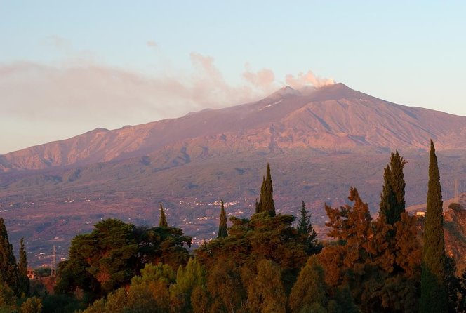
Mount Etna reaches for the clouds.
This tour puts you on the north side of Sicily’s active volcano, where it’s less packed and the scenery feels wilder and more volcanic. I love that you get the combo of 4×4 positioning plus a real summit hike, not a quick in-and-out stop. I also like the way guides act like working volcanologists, choosing the safest route as conditions change. One thing to plan for: the trek to the upper craters is genuinely demanding at high altitude, and it’s not ideal if you don’t train regularly.
The big win here is the pacing and support. Our guides adjust the effort for the group, with short breaks built into the climb, and they keep you moving in a way that actually makes 3,300+ meters feel possible. I also like the small-group setup (up to 10 people), which makes it easier to ask questions, get good sightlines, and feel like you have more space near the crater rims. If you’re hoping for long photo stops or a slow stroll, you might find the schedule tight.
The main consideration is difficulty. Even with help from the guide, the walk is steep and the air gets thin, so you should take the fitness notes seriously. If you arrive last in the line, you may still be rushed, and the cold at the top can bite faster than you expect.
In This Review
- Key Things I’d Actually Watch For
- North Etna, Not the Usual Tourist Route
- Where You Start: Piano Provenzana and the Meet-Up at Chiosco Bar Mareneve
- The 4×4 Ride: Getting High Without Pretending It’s Easy
- A note on winter driving
- Stop by Stop: What Happens on the Way to 3,380 m
- Stop 1: Piano Provenzana staging inside a 2002 lava area
- Stop 2: The Craters Sommitàli itinerary on the wild north slope
- Stop 3: The summit hike itself, from 2,960 m to 3,380 m
- Stop 4: Back to Piano Provenzana for the end of the day
- Guides, Pace, and the Real Meaning of Volcanic “Safety”
- Names you might hear, and the style you’ll feel
- The possible drawback: pace can be brisk on the summit trek
- Gear and What You Should Still Bring
- Summit Views: What You’re Actually Seeing Up Close
- Time of Day: Morning vs Afternoon Starts
- Price and Logistics: What You’re Paying for, and What Costs Extra
- Who This Tour Fits (and Who Should Skip It)
- A quick practical tip
- Should You Book Summit Etna North 3380 mt?
- FAQ
- How long is the excursion?
- What altitude do you reach?
- Is the tour suitable for kids?
- What fitness level do I need?
- What gear is included?
- Do I need to pay extra for the 4×4 vehicle?
- When does the tour start?
- What if weather or volcanic conditions are unsafe?
- Are contact lenses recommended?
- Can I bring a service animal?
Key Things I’d Actually Watch For
- Less-touristy north approach from Piano Provenzana, with a more personal feel
- Authorized volcanological guide guiding both the drive and the trek
- Altitude reality: 2,960 m to 3,380 m, with real exertion and thin air
- A guided, flexible route based on gas, heat, and fractures you can’t control
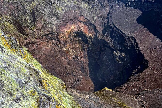
- You’ll feel the crater terrain up close: fumaroles, mineral colors, and scoria descents
- Cold and weather changes quickly near the summit, even in late-season months
North Etna, Not the Usual Tourist Route
If your Etna visit is based on photos of cable cars and quick crater lookouts, this will feel different. You start on the north side, from Piano Provenzana, and the plan is built around getting you high up, then earning the summit area on foot.
I like the mindset of this outing. The guide team doesn’t just lead a fixed path; they choose the safest route toward the most active yet secure crater area, because volcanic conditions can shift daily. That means you’re not treating this like a theme-park climb. You’re hiking in a living system.
And the best part for many people is that you’re not fighting crowds. The north route is described as less touristy, with smaller groups, and in practice it can feel like you’ve gotten a quieter view of the volcano’s power.
You can also read our reviews of more hiking tours in Sicily
Where You Start: Piano Provenzana and the Meet-Up at Chiosco Bar Mareneve
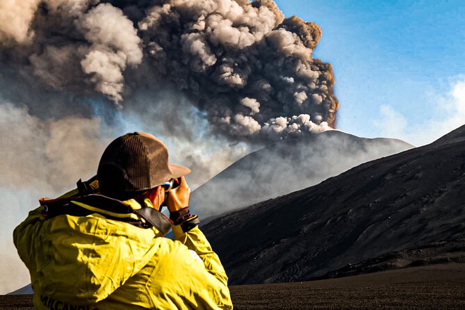
Your day begins back on the north side with a meeting point at CHIOSCO BAR MARENEVE DI FERRARO Etna nord–Piano Provenzana, Via Provenzana, 95015 Linguaglossa CT, Italy. Before you roll out, you’ll have time to use restrooms, grab coffee or tea, and (if you need it) breakfast from the café.
This matters more than it sounds. At Etna summit altitude, anything that slows you down later tends to show up fast. Getting settled early helps you avoid the panic of waiting in line, especially if the group heads out on a set schedule.
Piano Provenzana itself is easy to reach by car because the main access roads are paved. It’s also a place with practical services: souvenir spots, cafés and bars, and areas to refill water bottles. In winter it can function like a ski zone, while in warmer months it’s a hub for guided hikes.
The 4×4 Ride: Getting High Without Pretending It’s Easy
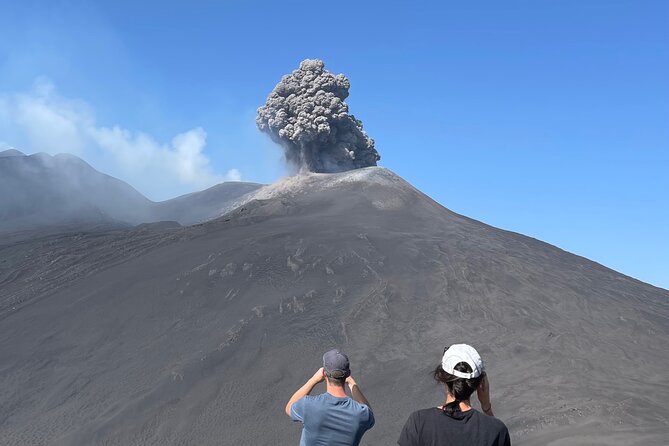
Once the guides are ready, you board authorized 4×4 vehicles for a panoramic drive on the northern flank. The big idea is that you don’t spend the whole day just climbing roads; you use vehicle access to jump into the volcanic zone.
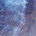
The drive portion can include routes with lava fields, lateral craters, and steep terrain. On one itinerary style, the 4×4 track climbs from about 1,800 m to around 2,960 m, using an unpaved panoramic track of roughly 9.5 km. Over that approach, you’ll cross elements like a lava-flow channel and eruptive fractures, which is why the “view” is also geology.
And yes, the ride can be bouncy. A review highlight called out the full experience, from the drive to the bouncing 4×4 up the mountain, then the hike to the crater rim. That’s the trade: a rougher ride in exchange for getting to the real hiking zone efficiently.
A note on winter driving
If you’re visiting in colder months, the access road can require snow chains or winter tires. This is especially relevant if you’re reaching Piano Provenzana by your own vehicle before the tour begins.
Stop by Stop: What Happens on the Way to 3,380 m
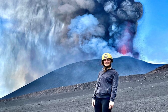
Stop 1: Piano Provenzana staging inside a 2002 lava area
At the first stop, you gather with the guide team and get briefed. You also start the excursion in a historic volcanic setting: Piano Provenzana was destroyed by an eruption on October 27, 2002, which reshaped the area into the volcanic terrain you’re working with today.
This part is less about spectacle and more about readiness. You’re checking equipment, getting guidance, and lining up with the group before the vehicle climb starts. If you’re the type who wants clarity, this briefing time helps you understand what you’ll be doing and why.
Stop 2: The Craters Sommitàli itinerary on the wild north slope
From the north-side meeting at around 7:45 a.m. with departure 8:00–8:15 a.m., this itinerary heads along a less touristed north route where groups are smaller. The drive is guided the whole way, and you’re not left to follow a trail or pretend you know where you’re going.
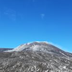
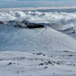
That route climbs from roughly 1,800 m to 2,960 m, and the terrain mix is part of the experience: forest, recent lava flows, deeper crater features (over 40 m deep is mentioned), and high-altitude volcanic zones that can look almost desert-like.
You also get big visibility on clear days. The drive track is described as offering views toward northern Sicily, the Aeolian Islands, the Strait of Messina, Calabria, and both the Ionian and Tyrrhenian Seas. On rare clear days, you can even see toward ranges like the Madonie and areas including the Gulf of Catania, Syracuse, and Augusta, plus the broad Valle del Bove.
Stop 3: The summit hike itself, from 2,960 m to 3,380 m
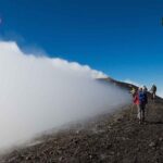
This is the heart of the day. You begin the summit hike around 2,960 m, reached by 4×4 vehicle positioning, then you walk toward the upper crater area.
The trek is described as about 5 km with around 550 m of ascent, climbing to the summit area where you can reach the rims of four main craters mentioned as North-East, Voragine, Bocca Nuova, and South-East. Exact access can shift because the volcano changes daily, and the guide picks the safest path toward the most active yet secure crater.
On top of that, the walking surface can feel unpredictable. Volcanic soil can be inconsistent and unstable, and the guide manages risk in real time. When you’re at altitude, you also tend to notice your body more quickly, so listen to the guide when they slow down or reroute.
How long is the whole hike segment? You’re looking at roughly 8–9 km total for the walking portion with about 4 km of descent and around 600 m drop, built into an overall time window of about 5 hours before the vehicle ride back.
Stop 4: Back to Piano Provenzana for the end of the day
After the descent, you return toward Piano Provenzana. The final 4×4 ride back is described as about 25–30 minutes, and the activity ends at the same meeting point.
This stop is your decompression time: cafés, bars, and spots to restock. If you want souvenirs, this is when you’ll likely have enough energy left to enjoy the browsing instead of doing it while exhausted.
Guides, Pace, and the Real Meaning of Volcanic “Safety”
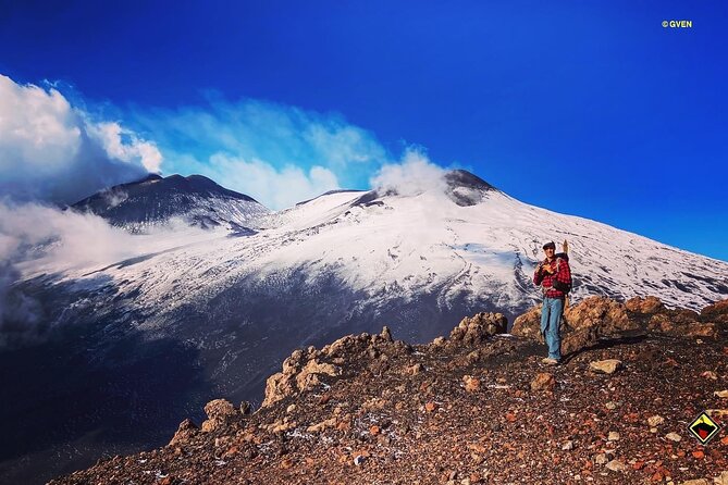
The tour is run with an authorized volcanological guide, and the guide’s job is not just pointing at craters. It’s interpreting conditions and adjusting the route if gas, heat, or fractures make a section unsafe.
That’s why the itinerary can vary. The tour can be interrupted or altered based on environmental, climatic, or volcanic changes that could undermine safety. That flexibility is a good thing, even if it means you might not see the exact crater angle you hoped for.
Names you might hear, and the style you’ll feel
Reviews included guides such as Andreo, Nikos, Francesco, and Vincenzo, with lots of praise for professionalism, detail, and enthusiasm. The best part of these accounts wasn’t just that the guides knew facts. It was that they managed the group well, including adjusting pace for slower walkers and building in brief rests.
The possible drawback: pace can be brisk on the summit trek
One review flagged that the trekking level can feel very difficult, with few breaks, limited time for pictures, and a sense of being pushed to keep moving. I’d take that seriously, not as drama, but as an indicator of what you’re signing up for: a high-altitude crater rim hike where timing affects safety and wind/gas exposure.
Gear and What You Should Still Bring
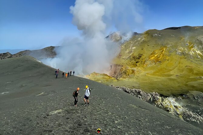
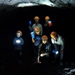
The tour includes a lot of trekking gear, including trekking shoes, trekking poles, socks, protective helmets, a backpack, jackets, and even accident insurance. That’s a strong value point if you’re traveling light or don’t want to shop for mountain gear in Europe.
Still, don’t assume “included gear” means “perfect for everything.” The notes recommend adding items like a k-way rain jacket, plus a hat and gloves for autumn, winter, and spring. I also strongly suggest sunglasses and sunscreen, because high altitude plus sun glare is a real combo.
One review specifically mentioned cold at the top in late September, around 2°C, and advised dressing in layers. That matches what you’d expect at 3,000+ meters, but it helps to hear it stated plainly before you show up in a single “light jacket” mood.
Summit Views: What You’re Actually Seeing Up Close
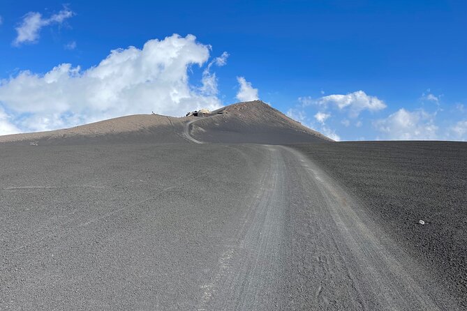
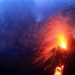
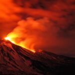
At the summit area, you’re walking near crater rims and fumaroles, with the chance to see volcanic gas and vivid mineral colors. You can also see recent lava formations, and your views can stretch across Sicily with the Ionian and Tyrrhenian Seas and even the Aeolian Islands on clear days.
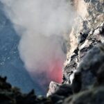
Some of the strongest praise in the reviews was about seeing active craters releasing material. Even when the volcano isn’t performing in a dramatic way, you still get the sensory experience: wind, heat/gas cues, and a stark contrast between green zones below and the higher barren terrain.
The “north side” angle also matters. One review described it as feeling like the volcano was almost yours because there were fewer people up there. While you can’t control crowd levels, the setup (smaller groups, wild north route) gives you a better chance of that kind of experience.
Time of Day: Morning vs Afternoon Starts
You’ll typically meet around 7:45 a.m. for a departure 8:00–8:15 a.m. for one schedule. There’s also an afternoon option at 1:00 p.m., running from May to October.
In practical terms, you can expect morning conditions to often feel colder and potentially clearer. Afternoon might suit you better if you want to sleep in and handle the climb with a more comfortable start. The key point: no matter the start time, the summit zone can still be cold and windy, so plan for layers.
Price and Logistics: What You’re Paying for, and What Costs Extra
The published price shown here is $78.61 per person, and it covers the tour experience with an authorized volcanological guide and the included gear items. But there’s an important add-on: the off-road vehicle fee is 60€ per person, paid on the spot, for the round trip from about 1800 m to 2825 m.
So the real budgeting picture is closer to: base tour price plus the 60€ vehicle fee, plus potential small extras like parking. The parking ticket is €5 on weekdays and €8 on Sundays and public holidays, and lunch is not included.
Also note the tour mentions a mobile ticket, and you’ll get confirmation at booking time. If you’re planning your day around it, assume the tour is weather-dependent: poor conditions can trigger a reschedule or a full refund.
Who This Tour Fits (and Who Should Skip It)
This excursion suits people with moderate physical fitness and encourages you to report health issues so the guides can reduce risk. It’s strongly discouraged for people with cardio-vascular problems, breathing problems, or hypertension.
It’s also not made for kids under 12. Service animals are allowed, which helps some travelers plan.
If you hike regularly and are comfortable with steep climbs at altitude, you’re the target audience. If you’re not doing physical activity regularly, this trek rising to around 3,300 m may feel punishing. One review went as far as saying you have to be an athlete or in very good physical shape.
A quick practical tip
Consider skipping contact lenses. The notes recommend you avoid them due to volcanic gases and ash, which could cause irritation. If you’re prone to dry eyes, bring glasses you can switch to quickly.
Should You Book Summit Etna North 3380 mt?
I’d book this if you want a real Etna summit day with small-group energy, guided safety decisions, and the chance to walk near active crater features. The combination of authorized volcanological guidance, gear support, and the higher-effort crater hike is what makes this worth it beyond the usual “ride up, stop, ride down” pattern.
I’d think twice if your goal is mostly sightseeing with lots of time to linger. The schedule can be tight at altitude, and the hike is demanding. Also, if you’re not comfortable with cold, wind, and thin air, this isn’t a gentle outing.
If you’re fit, prepared, and okay with being flexible because the volcano can change the plan, this tour can be one of the most memorable ways to experience Etna from the north.
FAQ
How long is the excursion?
It runs for about 5 hours on average.
What altitude do you reach?
You start trekking around 2,960 m and the summit area can reach about 3,380 m.
Is the tour suitable for kids?
No. It’s not suited for children under 12.
What fitness level do I need?
You should have moderate physical fitness and be able to handle a steep high-altitude trek. The notes discourage people who don’t do physical activity regularly.
What gear is included?
Included items include trekking shoes, trekking poles, socks, protective helmets, a backpack, and jackets, plus accident insurance.
Do I need to pay extra for the 4×4 vehicle?
Yes. The off road vehicle fee is 60€ per person, paid on the spot (round trip from about 1800 m to 2825 m).
When does the tour start?
A morning option meets around 7:45 a.m. and departs 8:00–8:15 a.m.. An afternoon start at 1:00 p.m. runs May to October.
What if weather or volcanic conditions are unsafe?
The excursion requires good weather, and it could be cancelled, offered on another date, or refunded if conditions don’t allow a safe experience.
Are contact lenses recommended?
No. The notes recommend not using contact lenses due to volcanic gases and ash.
Can I bring a service animal?
Yes. Service animals are allowed.