REVIEW · PRAIA
Santiago: Monte Tchota Natural Park to Pico d’Antónia Hike
Book on GetYourGuide →Operated by Bu Country Tours · Bookable on GetYourGuide
One climb, big views, real Cape Verde trekking. I love the Monte Txota micro-climate—cooler air and lots of biodiversity—and I also like how Elder’s guiding keeps you informed and moving at a realistic pace. The main drawback is that this is a genuinely difficult hike with a narrow, tilty trail and a one-way route, so you’ll want solid shoes and some fitness.
You’ll start with a drive to Rui Vaz, then climb up through Monte Txota’s protected area to Pico d’Antónia, Santiago Island’s highest point at 1,394 meters. If the weather cooperates, the payoff is huge: wide views over the São Jorge Valley and, at times, Maio Island and the Fogo Volcano in the distance. Just be ready for a long day outdoors—about 5 to 6 hours total with 4 to 5 hours of walking—and plan your energy accordingly.
In This Review
- Key highlights at a glance
- Starting in Rui Vaz and easing into Monte Txota
- Monte Txota to Pico d’Antónia: what the ascent really feels like
- The summit views: São Jorge Valley and distant islands
- The picnic stop: a small break that helps you finish strong
- Pace, safety, and why the guide matters on a narrow trail
- Trail reality check: distance, elevation, and what to wear
- Price and value: what you’re paying for at $100 per person
- Who should book this hike, and who should skip it
- Should you book Monte Txota to Pico d’Antónia?
- FAQ
- How long is the Santiago Monte Txota to Pico d’Antónia hike?
- How far do we hike, and how long is the walking time?
- Is the hike easy or difficult?
- How much elevation gain should I expect?
- Where do we start, and what’s the pickup area?
- What views are possible from near the summit?
- What’s included in the picnic?
- What should I bring for the hike?
- What languages are available for the guide?
- Is the tour suitable for everyone?
- Can I cancel and get a refund?
Key highlights at a glance
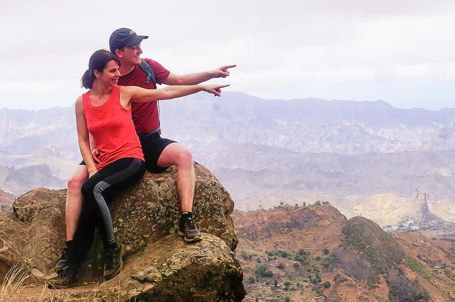
- Monte Txota’s cooler micro-climate: You’ll feel the change in temperature as you gain altitude.
- Pico d’Antónia (1,394 m): The highest point on Santiago Island, with serious island-hopping views.
- São Jorge Valley panoramic viewpoints: Great for photos and for getting your bearings fast.
- Weather permitting: Maio and Fogo: Distant sights can make the summit feel even bigger.
- Elder-style guidance: Helpful, safety-minded, and supportive when the path gets steep.
- 9 km trail with big elevation change: Difficult, but manageable with the right pace.
Starting in Rui Vaz and easing into Monte Txota
Your day kicks off with a drive to Rui Vaz, where the hike begins. This matters more than you might think. Starting outside the thick city noise helps your body settle into walking rhythm before the real climbing starts.
Then you enter Monte Txota Natural Park. At around 800 meters, the park has its own micro-climate. In plain terms: you often feel cooler here than in the lower areas of Santiago. That can make a big difference on a difficult climb. The park also has biodiversity, so the walk feels less like a straight line and more like moving through different pockets of plant life as altitude changes.
It’s also a good moment to get your “hike kit” right. You’ll want your sun hat on early, sunscreen applied, and your water within reach. The trail is not a flat stroll, and there’s no point arriving unprepared at the point where the climb starts demanding more from you.
You can also read our reviews of more hiking tours in Praia
Monte Txota to Pico d’Antónia: what the ascent really feels like
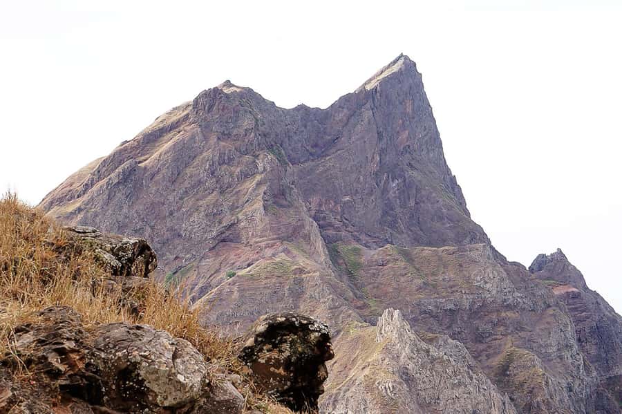
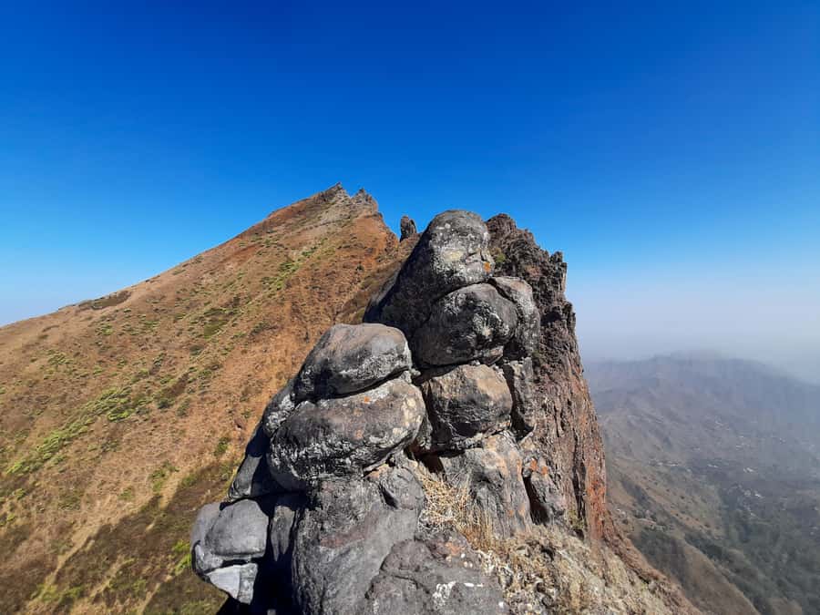
From Monte Txota, you continue uphill toward Pico d’Antónia, Santiago’s top. The maximum elevation is about 1,400 meters, and Pico d’Antónia itself is listed at 1,394 meters—so you’re in high-country terrain for the summit push.
The numbers tell the story. You’ll cover about 9 km total (±), with elevation gain around 660 meters. That’s a strong vertical effort for a hike that also includes a return drive later. The route type is one way, but your full day includes getting back toward Monte Txota and then riding to your hotel afterward.
The trail is described as narrow and tilty. Translation: you’ll need to watch your footing, especially where the path slopes sideways. This is where good hiking shoes earn their keep. If you rely on sandals or flimsy trainers, this hike can turn stressful fast.
From a practical standpoint, your best strategy is to keep your pace steady and let the guide set the rhythm. One of the nicest things about this tour is that your guide can usually keep you moving in a way that feels realistic. In past experiences with this route, Elder has been known for adjusting pace to the group, staying helpful, and looking out for safety when moments get harder.
The summit views: São Jorge Valley and distant islands
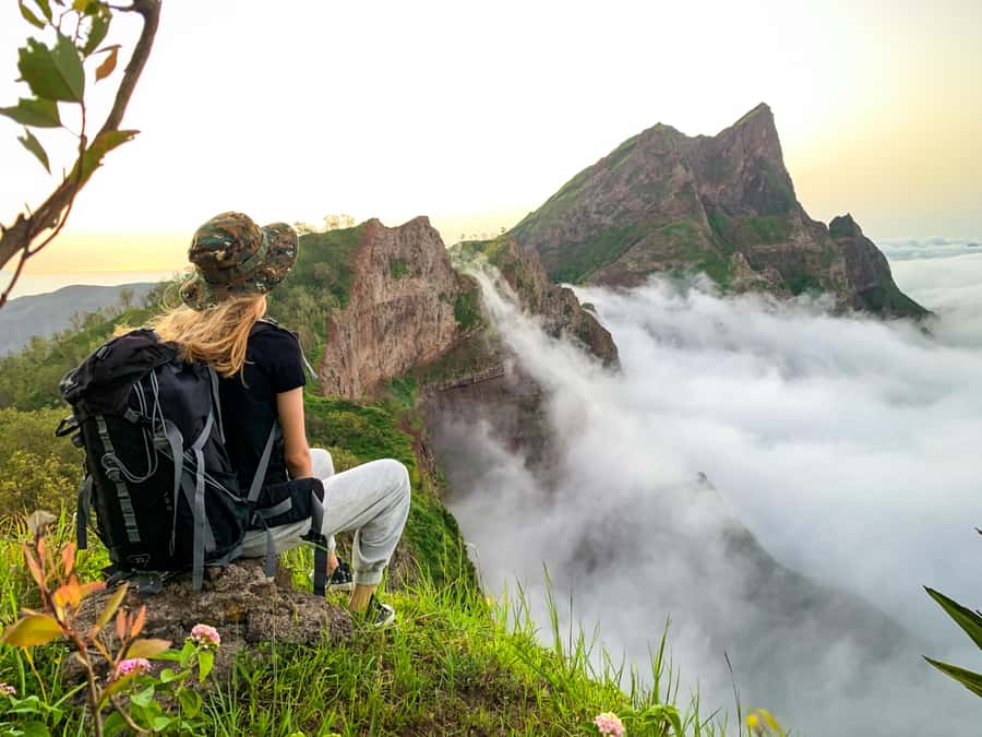
When you get close to the top, the hike starts paying you back in visuals. You’ll enjoy panoramic views over the São Jorge Valley. This is the kind of viewpoint where you can pause, look around, and finally understand the scale of Santiago.
Weather permitting, you might also be able to see Maio Island and the Volcano of Fogo in the distance. That optional “extra horizon” is one of the reasons this hike is popular. Even if you don’t see both, you’re still high enough to get sweeping sightlines across much of Santiago’s landscape.
A quick caution: distance views are weather dependent. If clouds roll in or visibility drops, you might mainly get local valley views. Still worth it, but don’t count on far-off islands every single time.
The picnic stop: a small break that helps you finish strong
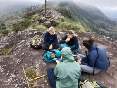
You’ll stop for a small picnic during the day. The included food is soft juice plus a sandwich and fruit. It’s not a fancy lunch, but it’s timed for a reason: a break that helps you refuel without wasting time.
I like picnic setups like this on climbs. They give you a moment to sit, loosen up your legs, and reset your focus before the next stretch. You also get a chance to enjoy the scenery without feeling like you must keep walking nonstop just to stay warm or “make time.”
Bring your own extra drinks if you can. The tour includes a simple picnic, but the day is long enough that you may want more hydration than you think, especially in sun exposure.
Pace, safety, and why the guide matters on a narrow trail
This is a difficult hike, and the trail type can keep attention on your feet. That’s where a strong guide becomes more than a nice extra. You want someone who can read the route, manage group spacing, and keep everyone comfortable with the climb.
The guide on this hike is live and multilingual, available in English, French, Spanish, and Portuguese. That flexibility helps if your group has mixed language comfort. You also have the option of private or small groups, which tends to make pacing and communication smoother.
Elder, in particular, has come through in multiple ways: knowledgeable about the natural areas you’re walking through, easy to understand, and attentive to group safety. In harder parts of the trail, that emotional support matters too. A steep section can feel easier when someone is watching your pace, not rushing you.
If you tend to get anxious on uneven ground, having a guide who stays present can change the entire experience. You’re not just “following,” you’re being managed and supported.
Trail reality check: distance, elevation, and what to wear
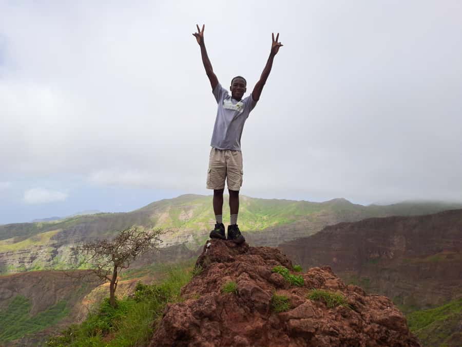
Let’s be blunt so you can plan confidently.
- Trail distance: about 9 km (±)
- Walking duration: about 4–5 hours
- Total duration: about 6 hours
- Difficulty: difficult
- Elevation gain: about 660 m
- Max elevation: about 1,400 m
- Path quality: tilty, narrow
- There may be some light scrambling or level 1 climbing on certain sections, so hiking pants are strongly advised.
The tour also advises wearing hiking pants, especially from August to November. That’s a seasonal practical note. Even if you personally prefer shorts, the route can be rougher than it looks from the outside. Hiking pants protect you from friction and help you move more confidently on uneven ground.
Walking sticks are also recommended in the advice provided. If you’re not used to sticks, practice with them briefly at home before the day. On narrow slopes, sticks can reduce strain and help you keep balance.
Clothing is only half the issue. You should also be ready to carry your own water and stay sun-smart. Sunscreen and a hat are on the official bring list for a reason: at altitude plus exposed sun, you’ll feel it.
Price and value: what you’re paying for at $100 per person
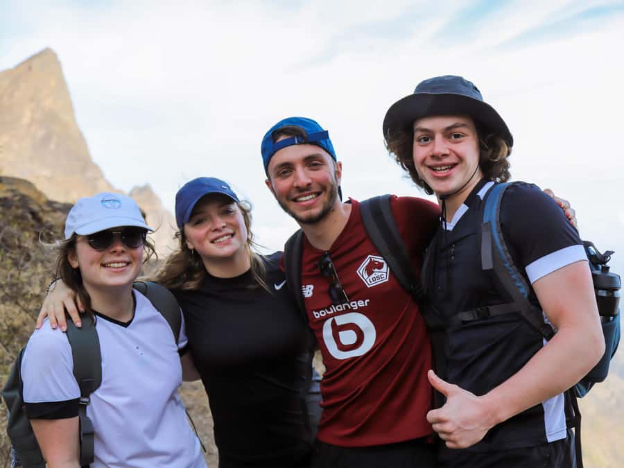
At $100 per person for a 6-hour guided hike, the value comes from four things: transport, a real guide, a provided picnic, and being in a protected area with a route that’s difficult enough to benefit from local management.
You get pickup and drop-off included if you’re staying in Praia or São Jorge dos Órgãos. If you’re not in those areas, there’s an extra fee for pickup and drop-off. So your true value depends on how close you are to the included starting area.
The package includes:
- Pickup and drop-off at your accommodation (Praia or São Jorge dos Órgãos)
- Transportation
- Tour guide
- Liability insurance
- Picnic (soft juice + sandwich + fruit)
For me, the best “value signal” is the guide element. This is not a beginner-level walk. Paying for a guide who can adjust pace, watch safety, and explain the natural surroundings is what makes a difficult trail feel like a guided hike rather than a private scramble you have to figure out yourself.
Who should book this hike, and who should skip it
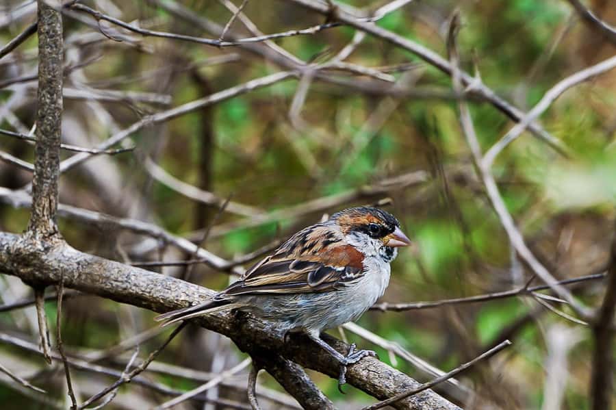
You’ll love this tour if you want a high-effort day outdoors with a clear summit goal. It suits walkers with some fitness and no health problems. The age minimum is 16 years old.
It’s also a great pick if you like learning while walking. The guide is set up for multiple languages, and the route passes through Monte Txota’s natural environment where explanations can add meaning to what you see.
Skip it (or look for an easier alternative) if any of these apply:
- Pregnant women
- People with mobility impairments
- Wheelchair users
- People with respiratory issues
The difficult rating plus narrow, tilty trail sections make this one about stability and stamina. If you’re unsure, be honest with yourself. A scenic view is only enjoyable when you feel in control of the physical demands.
Should you book Monte Txota to Pico d’Antónia?
Book this hike if you want a real challenge with big payoff views, and if you’ll take the gear and footwear advice seriously. The Monte Txota micro-climate can make the climb more comfortable, and the summit views over the São Jorge Valley are the kind of payoff that sticks in your memory.
If you’re sensitive to steep, narrow paths or you want an easy walk with minimal uneven ground, then this isn’t the right fit. This trek is difficult by design: it’s built around getting you high to see far.
One last helpful way to decide: bring the best version of yourself. Good shoes, hiking pants, hat, sunscreen, water, and a steady pace. If you do that, the day is far less intimidating and far more satisfying.
FAQ
How long is the Santiago Monte Txota to Pico d’Antónia hike?
The total duration is listed as 6 hours.
How far do we hike, and how long is the walking time?
The trail distance is about 9 km (±), and the total walking duration is about 4 to 5 hours (±).
Is the hike easy or difficult?
It’s rated as difficult.
How much elevation gain should I expect?
The elevation gain is about 660 m (±). The max elevation is about 1,400 m (±).
Where do we start, and what’s the pickup area?
The trek begins after a drive to Rui Vaz. Pickup and drop-off are included in Praia or São Jorge dos Órgãos.
What views are possible from near the summit?
You can expect panoramic views over the São Jorge Valley. Weather permitting, you may also see Maio Island and the Volcano of Fogo.
What’s included in the picnic?
The picnic includes soft juice, a sandwich, and fruit.
What should I bring for the hike?
Bring a sun hat, drinks, hiking shoes, sunscreen, and water. Hiking pants are strongly advised, and hiking sticks may be helpful.
What languages are available for the guide?
The live tour guide is available in English, French, Spanish, and Portuguese.
Is the tour suitable for everyone?
It’s suitable for travelers over 16 years old and for walkers with some fitness and no health problems. It’s not suitable for pregnant women, people with mobility impairments, wheelchair users, or people with respiratory issues.
Can I cancel and get a refund?
Yes. Free cancellation is available up to 24 hours in advance for a full refund, and you can reserve now and pay later.