REVIEW · PUEBLA CITY
Hiking in Iztaccihuatl Volcano
Book on Viator →Operated by Hiking Puebla · Bookable on Viator
Volcano views start before your boots hit mud. This guided hike in the Iztaccíhuatl–Popocatépetl National Park mixes Paso de Cortés high-altitude starting points with nonstop sightlines toward Popocatépetl as you climb. You’re also in the right place for big-mountain panoramas, with views that can reach Pico de Orizaba, Malinche, and Sierra Negra on clear days.
What I like most is the way the route changes by altitude: forest to alpine scrub to rocky volcanic ground, without feeling like a different trip each hour. You’ll pass pine, oak, and oyamel forests, and you might spot mountain roses and the endemic Teporingo rabbit if conditions cooperate.
The main consideration is altitude and timing. You’ll end around 4,000 meters (and you can go higher), and the hike depends on good weather, so it’s not the best choice if you’re hoping for an easy stroll.
In This Review
- Key highlights at a glance
- Getting Above Puebla: Starting at Paso de Cortés (3,500 m)
- What You’ll See: Popocatépetl Up Close, Plus the Big-Mountain Trio
- The Forest-to-Rocks Walk: Pine, Oak, Oyamel, and Teporingo Country
- Stop 1: Popocatépetl Viewing Break and How to Use It
- Stop 2: Iztaccíhuatl Views and the Meaning of the Name
- Pace, Stops, and the 7-Hour Walk That Doesn’t Treat You Like a Robot
- Included Food and Drinks: Fuel for Thin-Air Legs
- The Optional Extension: Going to 4,200 m (and Why You Should Think About It)
- Getting There From Puebla: Pickup That Covers Most of the City
- Private-Group Feel, English Support, and Why It Changes the Day
- Price and Value: What $119.56 Really Buys You
- Who Should Book This Iztaccíhuatl Hike (and Who Should Skip It)
- FAQ
- FAQ
- How long is the hike on foot?
- Where does the hike start?
- How far will I walk?
- What altitude do we reach?
- Are snacks and drinks included?
- Is pickup included from Puebla?
- What happens if the weather is bad?
- Should You Book This Iztaccíhuatl Hike From Puebla?
Key highlights at a glance
- Paso de Cortés start (3,500 m) means you begin already in thin-air mode
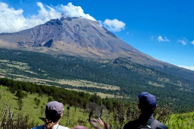
- Popocatépetl sightings on the ascent with its fumaroles in view
- A terrain shift with altitude: pine/oak/oyamel forest to scrub to volcanic rocks
- Included breaks and fuel: snacks, fruit, and energy drinks during rest stops
- Optional extension up to 4,200 m and an extra walking option to 18 km
Getting Above Puebla: Starting at Paso de Cortés (3,500 m)
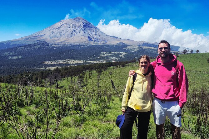
This is a long-day hike, but it feels purposeful from the first step. You begin around 3,500 meters at Paso de Cortés inside the national park. That matters because high altitude changes everything: breathing, pace, and how your legs feel even before the serious views start.
Your day also starts early enough to make the most of daylight. The total experience time is about 12 hours including pickup and time on the move, while the walking itself is around 7 hours. Plan your expectations around that split: you’re not spending the whole time hiking hard, but it won’t be a short, casual outing either.
You’ll be in sports clothing and proper hiking shoes territory. The terrain later turns rocky, so sneakers can turn into a regret. If you’ve got ankle-support boots or trail shoes you trust, bring them.
You can also read our reviews of more hiking tours in Puebla City
What You’ll See: Popocatépetl Up Close, Plus the Big-Mountain Trio
The star attraction is the volcanic drama. During the ascent, you get views of Popocatépetl, including fumaroles and that imposing presence that makes this region famous. When you’re this high up, you’re not just looking at a landmark—you’re looking at an active volcano from a distance that still feels close.
Then the wider panorama kicks in. As you climb, the trail offers chances to see Pico de Orizaba (Mexico’s highest mountain), plus Malinche and Sierra Negra. Even if clouds roll in, you still get the experience of hiking inside a volcanic system rather than hiking in front of it.
One smart way to handle volcano viewing is to treat it like a moving viewpoint. Don’t rush from stop to stop. Use the planned rest moments as photo moments. At altitude, the fastest path is the one that doesn’t spike your breathing too much.
The Forest-to-Rocks Walk: Pine, Oak, Oyamel, and Teporingo Country
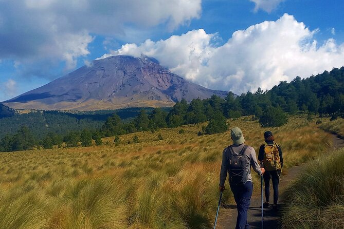
I love hikes where the biology feels real, not just scenic. This one starts in a forested band where you may see pines, oaks, and oyamels. You’re walking through an environment that sits in layers of altitude, so it feels alive and specific.
As you climb, the vegetation shifts. The route moves from leafy forest conditions to more alpine scrub, and eventually into rocky and volcanic terrain. That transition is one of the most valuable parts of the experience because it tells you you’re changing altitude in a noticeable way, not just gaining height by numbers.
There’s also a chance to spot the Teporingo rabbit, sometimes called the volcano rabbit, which is endemic to this area. You probably won’t see one on cue. But knowing that you’re in the habitat makes you look more carefully, and that’s where the magic often comes from.
If you like nature details, this route gives you enough to keep your brain busy. If you just want views, the terrain change still keeps the hike from feeling monotonous.
Stop 1: Popocatépetl Viewing Break and How to Use It
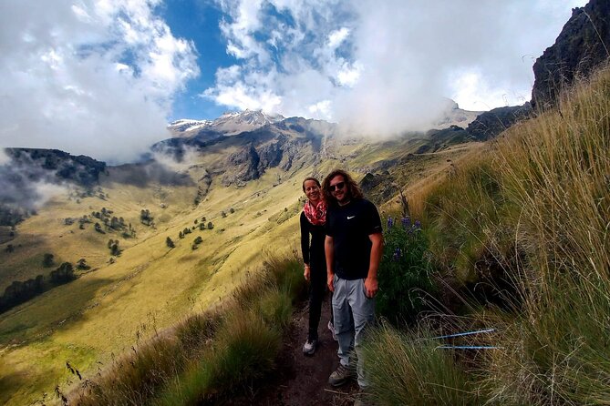
The day includes a specific stop focused on Popocatépetl. This is the part you’ll remember afterward because it’s the moment where the hike stops being abstract and becomes very real.
At that point, you’ll likely be able to see fumaroles and get a stronger sense of scale. What I’d do in your shoes is use the stop to reset your pace for the next stretch. Don’t “power through” right before a viewing moment. Let the guide’s timing work for you.
Also, use the stop like a mini-altitude lesson. If you feel lightheaded earlier in the hike, treat it as a sign to slow down. You won’t fix altitude by walking faster. You fix it by breathing calmer and taking the hydration breaks the guide sets.
Stop 2: Iztaccíhuatl Views and the Meaning of the Name
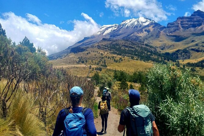
Later, the itinerary includes a second major stop centered on Iztaccíhuatl. This is where the hike leans into the meaning of being on the mountain’s side, not just hiking through it.
Iztaccíhuatl is known for its recognizable silhouette, and being at the right height during a clear moment helps the mountain feel more than a name on a map. Even if visibility is imperfect, the stop still matters. It gives you a structured moment to look, catch your breath, and take in what you’ve climbed into.
This part of the day also helps you understand the route design. The hike doesn’t just “go up.” It layers your experience: volcano first, then the broader Iztaccíhuatl presence as you continue to gain altitude.
Pace, Stops, and the 7-Hour Walk That Doesn’t Treat You Like a Robot
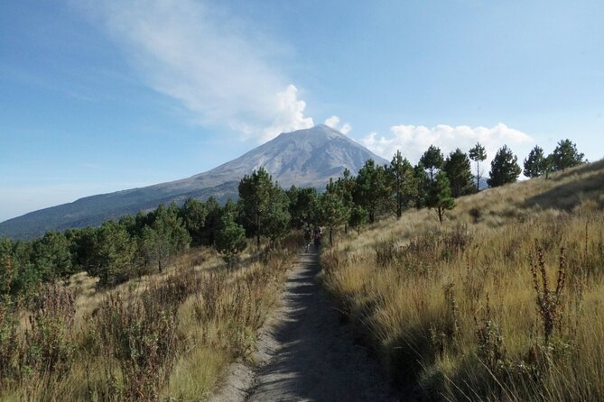
The walking portion is about 7 hours, and the route is roughly 15 km, with an option to extend up to 18 km. That’s solid hiking distance, and you should expect effort. But it’s not a nonstop grind.
You’ll also make several technical stops during the climb—places to rest, hydrate, and enjoy the included food. This approach is practical at altitude. If you wait until you’re already exhausted to hydrate, you’re behind the game.
The guide will keep the day moving, but it’s not designed for sprint pace. In the feedback, guides like Carlos and Mario are mentioned by name for being reliable and considerate, which is exactly what you want when you’re sharing a steep trail with your own lungs doing the work.
My advice: start slower than you think you need. You can always speed up later. At altitude, trying to match flatland fitness usually backfires.
Included Food and Drinks: Fuel for Thin-Air Legs
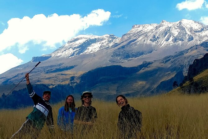
One of the smartest values here is that food and drinks are included during the ascent. You get snacks, fruits, and energy drinks during the stops. That doesn’t just feel nice. It affects how well you hike.
High altitude turns energy demand up. Even if you feel fine early, your body can start asking for more calories and fluid later. Having it handled by the tour means you’re less likely to under-fuel because you forgot something at home.
Try not to treat the snacks like a dessert break. Think of them like maintenance. Small bites at the planned moments can keep your energy steadier than one big meal when you’re already tired.
Also, hydration is not optional here. The stops are built in for a reason.
The Optional Extension: Going to 4,200 m (and Why You Should Think About It)
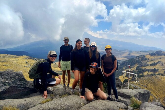
The hike ends around 4,000 meters above sea level, with an option to extend up to 4,200 meters for the more adventurous. That extra height can turn the hike from challenging to noticeably harder, even if you’re fit.
This is where the tour’s structure helps. You’re already in rhythm with the guide’s timing and the planned stops. If you choose the extension, you’ll still have those supports rather than deciding mid-hike to wing it.
Before you say yes, ask yourself a simple question: do you feel in control of your breathing and pace at 4,000 meters? If yes, the extra altitude may feel like a strong finisher. If not, staying at the planned end point is still an accomplishment.
Either way, you’ll come away with the sense that you did more than a sightseeing walk—you climbed into high-mountain conditions.
Getting There From Puebla: Pickup That Covers Most of the City
A big part of comfort is how smoothly you get to the trailhead. Pickup is offered across most of Puebla, covering hotels, hostels, and Airbnbs. You just share your accommodation name and/or address, and the pickup service handles the rest.
That matters because this kind of hike punishes wasted time. When you’re already dealing with altitude and distance, every delay adds stress. A clear pickup plan reduces friction, and it lets you focus on the hike.
You also get a mobile ticket, which is a small thing but makes the day simpler when you’re balancing water, layers, and navigation.
Private-Group Feel, English Support, and Why It Changes the Day
This is a private tour/activity, meaning only your group participates. That can be a big deal on narrow trails and steep sections, where too many hikers can spread out unevenly.
English is offered, so you won’t have to guess what the guide means when talking about stop points or what you’re seeing. And because the stops are built into the itinerary, having a guide communicate clearly makes those breaks more useful, not just more waiting.
In the feedback, the guides’ demeanor stands out—Carlos and Mario are described as reliable and considerate, which fits the needs of a high-altitude outing. You want someone calm when the route gets tougher.
Price and Value: What $119.56 Really Buys You
At $119.56 per person, this isn’t a budget walk. But it does include several things that add up when you hike like this in the real world.
You’re paying for:
- Pickup across Puebla, which reduces wasted morning time
- A guided experience inside the Iztaccíhuatl–Popocatépetl National Park
- Included snacks, fruits, and energy drinks during technical stops
- A structured high-altitude route, including rest and hydration planning
- English support and a private-group setup
If you tried to DIY this hike, you’d still need transport, route planning, and enough food and drinks to cover long stops at altitude. You might even need a guide to feel confident about where and when to stop. This price packages that work into one ticket.
So the value comes from reduced uncertainty and better pacing. You’re not just buying access to a trail—you’re buying a plan that fits the altitude and the terrain.
Who Should Book This Iztaccíhuatl Hike (and Who Should Skip It)
I think this hike is a great fit if you:
- Want a real altitude experience rather than a casual viewpoint walk
- Enjoy hiking that changes terrain from forest to scrub to rocky volcanic ground
- Like having structured breaks and fuel instead of carrying everything yourself
- Prefer a smaller, private-group feel and clear English guidance
You might want to think twice if:
- You’re expecting a gentle walk. The distance and altitude are legit.
- Your schedule can’t handle a full 12-hour day.
- You’re sensitive to altitude or you don’t have hiking shoes you trust.
The good news: the tour is designed with several stops and included food/drinks, which helps most people manage the difficulty better than a do-it-yourself attempt.
FAQ
FAQ
How long is the hike on foot?
The walking time is about 7 hours, with the full experience lasting about 12 hours including pickup and other time on the move.
Where does the hike start?
It starts at Paso de Cortés inside the Iztaccíhuatl–Popocatépetl National Park at about 3,500 meters above sea level.
How far will I walk?
The distance is about 15 km, with an option to extend to about 18 km.
What altitude do we reach?
The end of the hike is around 4,000 meters, with an optional extension up to about 4,200 meters.
Are snacks and drinks included?
Yes. You’ll have included food during technical stops, including snacks, fruits, and energy drinks.
Is pickup included from Puebla?
Yes. Pickup covers most of Puebla (hotel, hostel, Airbnb, and other accommodations), and you share your accommodation name or address.
What happens if the weather is bad?
The experience requires good weather. If it’s canceled due to poor weather, you’ll be offered another date or a full refund.
Should You Book This Iztaccíhuatl Hike From Puebla?
If you want a guided high-altitude hike with real volcano views, I’d book it. You get a smart route structure starting at 3,500 meters, a chance to see Popocatépetl during the climb, and terrain changes that keep the day feeling fresh. The included snacks, fruits, and energy drinks make a noticeable difference at altitude, and the guides Carlos and Mario are specifically praised for being reliable and considerate.
Just be honest about your fitness and comfort with altitude. Bring proper shoes, dress for changing mountain conditions, and treat the planned stops like part of the plan, not interruptions. If you do that, this is the kind of day trip that leaves you with a clear memory of volcano scale—and how it feels to walk inside it.