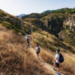
REVIEW · GRANADA
From Granada: High Sierra Nevada hiking experience
Book on GetYourGuide →Operated by NEVADA GUIDES · Bookable on GetYourGuide
Mulhacen gets real fast when you start high. This Granada-to-Sierra Nevada hike jumps you up near 2,500 meters and then takes you off the main routes into glacial valleys, where you can spot Spanish mountain goats and watch water carve the rock. The small group setup also helps you hear more wind than traffic.
I especially love two things: first, the wildlife moments. On this hike you’re in prime terrain for ibex (mountain goats) and eagles, plus birds moving through the area. Second, I like how the geology lesson stays practical: you learn how the collision of Africa and Eurasia shaped what you’re walking on, then you look at the results—glacier-scoured rock, shiny surfaces, and water features along the way.
One consideration: this is short on distance but not soft on your legs. Even with an “easy pace,” you’ll climb and hike on rocky, uneven ground at altitude, so good traction shoes matter, and bad weather can sometimes mean a slightly lower turnaround point.
In This Review
- Key highlights you’ll remember
- Granada to 2,500m: the smartest way to start a high-altitude day
- San Juan Valley: follow the glacier’s footsteps and the water’s route
- Tajos del Campanario: the steep angle that makes the summit views worth it
- Wildlife moments: when the quiet hike pays off
- The guide (Jaime) and the dog duo (Kai): why this feels personal
- How hard is it, really? Distance, elevation, and rocky footing
- Gear and what you should pack (don’t skip this part)
- Food and water: plan for a mountain refresh
- Timing, pacing, and weather: why the route can change
- Price and value: what you’re paying for (and what you’re not)
- Who should book this Sierra Nevada hike (and who should skip it)
- Should you book the Granada to High Sierra Nevada hike?
- FAQ
- FAQ
- Where is the meeting point in Granada?
- How long is the tour from start to finish?
- How much walking is involved?
- What group size is this hike?
- What languages are the guides?
- What’s included in the price?
- Is food and water included?
- What should I bring?
- What shoes are not allowed?
Key highlights you’ll remember
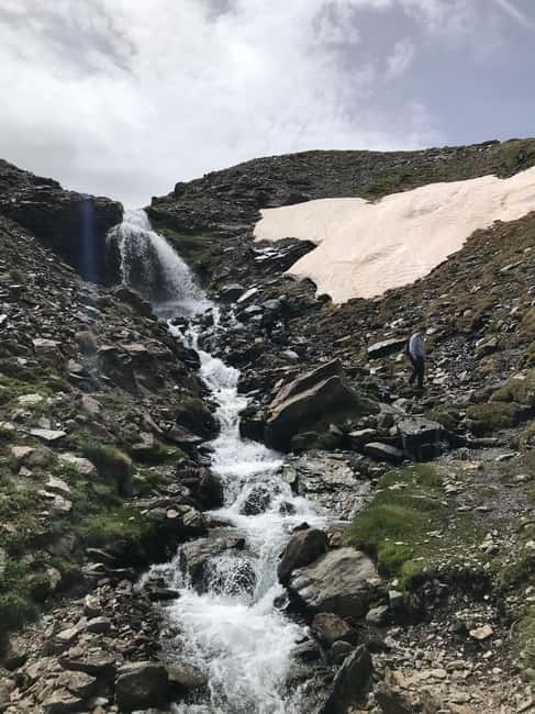
- San Juan Valley glacial scenery: you follow the ice’s handiwork and the streams it still feeds
- Tajos del Campanario viewpoint: the north face of Mulhacén (and the big neighbors) comes into focus
- Spanish mountain goats and birds: wildlife sightings happen because the hike goes where it’s quieter
- Small group, up to 8: easier conversations with guide and fewer people to compete with for views
- Real gear support: hiking poles and a winter-friendly clothing layer plan are included if needed
Granada to 2,500m: the smartest way to start a high-altitude day
The day begins in central Granada with pickup from the city center, then a drive up toward the Sierra Nevada Road. You’re taken to around 2,500 meters above sea level before walking starts, which means you’re not spending your morning dragging yourself uphill from sea-level.
You’ll meet your group at the statue in the middle of the square. From there it’s small-group logistics and then time in the mountain air. With a group of up to 8, the guide can actually watch footing, pacing, and energy levels—especially useful when the terrain turns steep or slippery.
This is the kind of setup that makes sense if you want a big day out without spending the rest of your vacation on bus rides and transfers. The total duration is about 7 hours, but the walking is around 5 hours including breaks, plus roughly 1 hour of transfer time in each direction.
You can also read our reviews of more hiking tours in Granada
San Juan Valley: follow the glacier’s footsteps and the water’s route
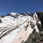
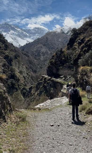
Once you’re on the trail, one of the best parts of the experience is that it isn’t just about reaching a viewpoint. You move through the San Juan Valley, described as one of the most beautiful glacier valleys in Sierra Nevada.
Here’s what makes this section feel special for you: you’re physically walking through evidence. The guide explains how the ice excavated the rocks over thousands of years, and you see it as you go—shaped slopes, exposed rock, and the sense that the valley was carved by a force far bigger than hiking.
You also get water along the way. Expect pristine streams and waterfalls, not as a single postcard stop, but as recurring moments that break up the hike and keep the scenery fresh. In high summer, that water also helps you feel less cooked by the sun; in colder months, it’s a reminder that this range holds onto snow and ice longer than the city.
And because this hike goes off the beaten path, you often get that rare high-country feeling: wind sounds, distant birds, and stretches where you’re not constantly negotiating other people.
Tajos del Campanario: the steep angle that makes the summit views worth it
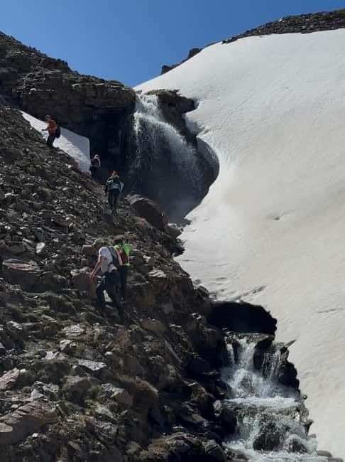
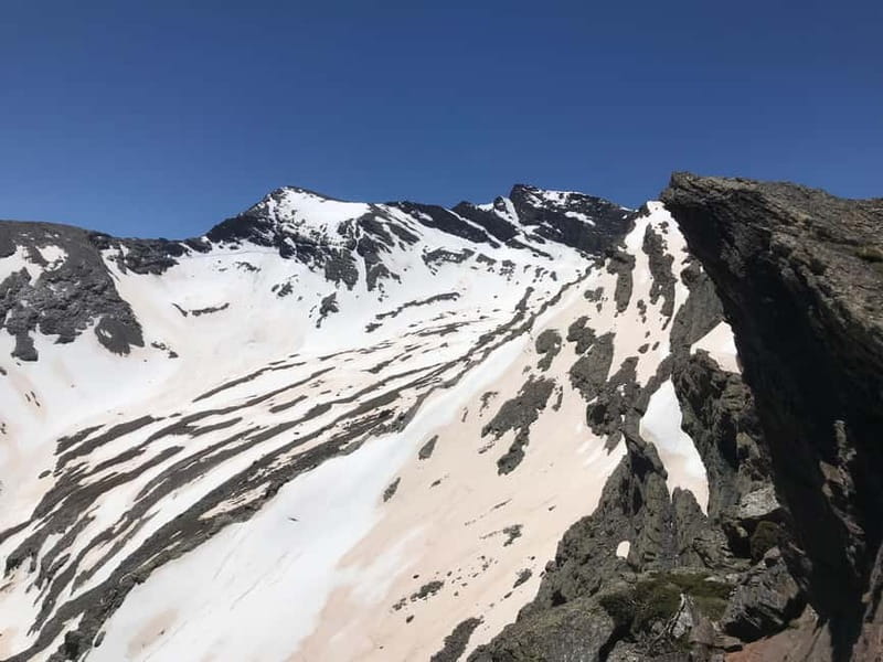
The hike climbs to Tajos del Campanario, where the walking route pushes you above 3,000 meters in the higher-season plan. In plain terms: the route is short (around 8 kilometers / 5 miles) but it can feel like more because of the altitude and the rocky footing.
This is where the guides’ experience really matters. The guide sets an easy pace for the group, with multiple stops to rest and take pictures. You don’t need to be a hardcore hiker, but you should be ready for steep sections and uneven ground. Several people in the same category described it as challenging at moments, even though the overall structure is manageable.
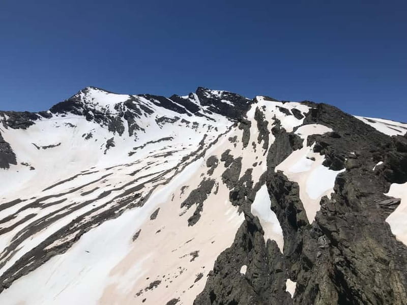
From the viewpoint area, you get dramatic views of the north face of Mulhacén—the highest peak in the Iberian Peninsula at 3,480 meters—plus views toward Veleta and Alcazaba. Even when you’re not standing on Mulhacén itself, you’re seeing the mountain’s scale up close, and you’re getting that “how is that wall still there?” feeling.
If weather forces adjustments, you’ll still get strong views at a lower altitude. The key point is that you’re not doing this blind: the guide reads conditions and chooses the best safe route for the day.
Wildlife moments: when the quiet hike pays off
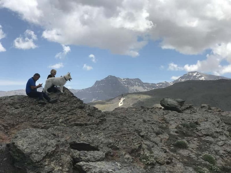
A big reason this hike gets such a high response is simple: it puts you in the right places for wildlife.
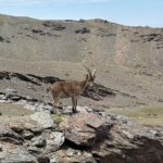
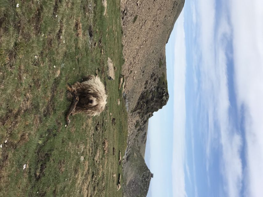
Because you’re away from the busiest routes, you have more chance to observe Spanish mountain goats (ibex) in their natural habitat rather than hearing about them later. Wildlife sightings aren’t guaranteed, but when they happen, they’re memorable because the setting is so high and quiet.
You can also look for birds such as eagles, along with migrating birds that pass through the region from Africa. Even if you don’t track every species, the overall feel is that you’re in an ecosystem with its own rhythms—plants, insects, and birds that handle this altitude and exposure.
One practical takeaway: keep your eyes up and your camera ready, but don’t rush the moment. Let the guide settle the group, then enjoy. On rocky slopes, moving too fast to chase a sighting is the fastest way to slip.
The guide (Jaime) and the dog duo (Kai): why this feels personal
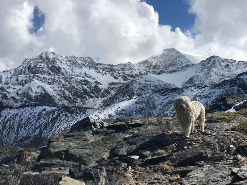
The experience runs best because the guiding is built around safety and storytelling that matches what you’re seeing.
Jaime is part of what makes the day click. He’s the kind of guide who talks while walking—about plants, rocks, and how the terrain formed—without turning it into a lecture you have to survive. Multiple people noted that he helps you manage the climb when it gets tough, including advice for pacing at altitude.
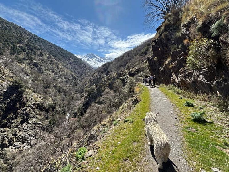
Then there’s Kai, the mountain dog who often joins the group. If you’re a dog person, it turns the day lighter. If you’re not, the upside is that Kai also adds calm energy and helps with the group vibe. Either way, it’s a distinctive part of the tour identity.
Small group size also helps here. You’re not stuck behind a wall of people; you can ask questions, adjust at breaks, and feel like you’re moving with the group rather than just following along.
How hard is it, really? Distance, elevation, and rocky footing
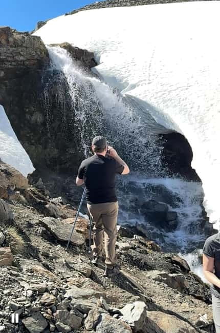
The “numbers on paper” look reasonable: 8 kilometers (about 5 miles) total, with about 600 meters of elevation gain (around 1,900 feet). The guide sets a pace for the group, with frequent breaks for pictures and rest.
But your legs may still feel it, because Sierra Nevada hiking isn’t just about straight-line effort. Expect rock-heavy sections and some unstable ground, meaning traction is more important than raw fitness.
Also, altitude changes the effort. Even if you don’t feel winded, you may feel slower or more alert in your breathing. That’s why the pacing and rest stops matter. If you’re tired, the good news is you’ll find spots where you can wait for the rest of the group during the return rather than powering through past your comfort level.
Who should feel good about this:
- If you regularly do sports or hikes, you’ll likely enjoy it a lot.
- If you’re new to hiking, you can still do it with solid shoes and a willingness to take breaks.
Who should think twice:
- The tour isn’t suitable for people with heart problems or respiratory issues, based on the activity requirements.
Gear and what you should pack (don’t skip this part)
You’ll be glad you planned your footwear. The hike includes steep and rocky terrain, so wear something with grip. Trainers can work for some people, but many participants strongly preferred proper shoes because of uneven surfaces and sometimes snow or wind.
What’s included:
- Hiking poles
- Backpack
- Warm clothing layers if necessary (polar fleece, rain jacket, gloves, and hats)
- Assistance planning from a guide team with liability insurance and assistance insurance
- In winter conditions, snowshoes provided for free
What you must bring:
- Sunscreen
Also, come prepared with common sense mountain habits:
- Avoid sandals or flip-flops. No high-heeled shoes either.
- Expect sun at altitude. Even if it feels cool at the start, conditions can change quickly.
Food and water: plan for a mountain refresh
Food and water are not included. The upside is simple: you’ll have a chance to buy water and snacks at the starting point of the hike in a mountain hostel.
This matters because high-altitude walking is steadier if you keep fueling. A quick snack before you start and water in your daypack helps you enjoy the climb rather than just survive it.
If you tend to get hungry on hikes, pack a little extra if the hostel option isn’t your vibe. Just keep it practical—nothing heavy or bulky.
Timing, pacing, and weather: why the route can change
This is a seven-hour day. Within that, you’re walking about five hours, and the rest is transfer time and breaks.
Weather affects where you can comfortably go. Some days you’ll get the planned high viewpoint experience; other days the guide may adjust the route for wind, snow, or safety. That’s not a failure—it’s part of how a good mountain guide keeps the day both fun and safe.
Bring the right attitude: be ready for a different view if conditions change. You’ll still be hiking in the Sierra Nevada high country, still seeing glacial-shaped terrain, and still getting those wide north-face views when conditions allow.
Price and value: what you’re paying for (and what you’re not)
At $69 per person for a 7-hour guided experience, the value mostly comes from what’s included.
You’re paying for:
- Small group logistics (up to 8)
- Transfers to and from Granada city center
- A professional mountain guide with UIMLA background and 30+ years of experience
- Safety coverage via insurance
- Practical hiking support: poles, backpack, and clothing layers if necessary
You’re not paying for:
- Food and water
For me, that’s a fair trade. You’re buying a safe, guided, gear-supported day up in the mountains without needing to figure out transport, route complexity, or cold-weather basics on your own.
Who should book this Sierra Nevada hike (and who should skip it)
Book this if:
- You’re visiting Granada and want one unforgettable day that takes you well beyond city sightseeing.
- You like nature hikes with wildlife potential and real geology explanations you can test with your own eyes.
- You want a moderate hike that still has enough challenge to feel worth the effort.
Consider skipping if:
- You have heart or respiratory conditions (the activity isn’t suitable).
- You hate rocky footing or you’re uncomfortable adjusting to changing weather.
- You’re looking for a flat, easy stroll.
Should you book the Granada to High Sierra Nevada hike?
If you want a day that feels like a real Sierra Nevada experience—glacial valleys, waterfalls, ibex sightings, and serious mountain views—this is a strong choice. The small group size, the guide’s long experience, and the extra layer of fun from Kai add up to more than just “getting from point A to B.”
My practical advice: book it if you can commit to good shoes and a steady pace. Skip it only if your medical situation makes altitude a concern or if rocky, steep sections would stress you out.
FAQ
FAQ
Where is the meeting point in Granada?
You’ll meet at the statue in the middle of the square.
How long is the tour from start to finish?
The total duration is about 7 hours.
How much walking is involved?
The walking time is approximately 5 hours, with breaks included, plus about 1 hour of transfer time from/to Granada.
What group size is this hike?
It’s a small group tour limited to up to 8 participants.
What languages are the guides?
The live tour guide works in English and Spanish.
What’s included in the price?
Included are transfers to and from Granada city center, a professional mountain guide (UIMLA), liability and assistance insurance, hiking poles, a backpack, and warm clothes if necessary.
Is food and water included?
No. Food and water aren’t included, but you can buy them at the mountain hostel at the starting point of the hike.
What should I bring?
Bring sunscreen.
What shoes are not allowed?
High-heeled shoes and sandals or flip flops are not allowed.