REVIEW · OAXACA CITY
Sierra Norte Hike and Indigenous Village Full-Day Adventure
Book on Viator →Operated by Valterra Excursiones · Bookable on Viator
Cold pines, high views, and real village life. This full-day Sierra Norte adventure takes you from Oaxaca City up to Cuajimoloyas, where you’ll hike through pine forest, learn from a local community guide, and spend the day around authentic mountain routines. I love the home-style mountain meals and the indigenous village focus, not just a workout for the sake of a workout. One thing to consider: it’s a moderate hike at altitude, so you’ll want solid fitness and the right layers.
The day runs in a small group, up to 6 people, and it’s guided by a professional bilingual team. Ivan is the host many people rave about for his practical, organized approach, plus he brings a local guide to add cultural and nature context you won’t get in a hurry.
In This Review
- Key takeaways before you go
- Sierra Norte hike day: what makes Cuajimoloyas different
- Price and value: why $107.54 can work for your budget
- The full-day schedule, in plain English
- Stop 1: Templo de San Matías Jalatlaco meeting point
- The 90-minute drive to Cuajimoloyas: expect mountain air
- Breakfast in the mountains: memelas and coffee
- The hike start: 8 km total, moderate but real
- What you’ll see while climbing
- Views, plants, ferns, and giant agaves in the Sierra Norte
- Crossing the 100+ meter suspension bridge (and the 70-peso fee)
- Lunch in the village: homemade mountain food
- Why the two guides make the day feel worth it
- Altitude and conditions: your best move is planning layers
- Who should book this hike (and who should skip it)
- Should you book this Oaxaca-to-Cuajimoloyas hike?
- FAQ
- How long is the hike during the tour?
- What is the meeting point in Oaxaca City?
- What time does the adventure start and end?
- What’s included in the price?
- Is the suspension bridge included?
- What kind of hike difficulty should I expect?
- How cold should I dress for?
- What language is the tour offered in?
- How big is the group?
- Is the tour refundable if plans change?
Key takeaways before you go
- Small group size (max 6) keeps the pace friendly and the hike from feeling like a cattle drive
- Breakfast and lunch are included and served mountain-style in a local comedor
- A 5-mile hike with altitude means you’ll feel it, even if the route stays doable
- Crevasse and rock-wall sections add a bit of hands-on scrambling
- A 100+ meter suspension bridge is the optional wow moment, but it costs 70 pesos
- Hiking poles and refill water are included, which helps you start the day prepared
Sierra Norte hike day: what makes Cuajimoloyas different
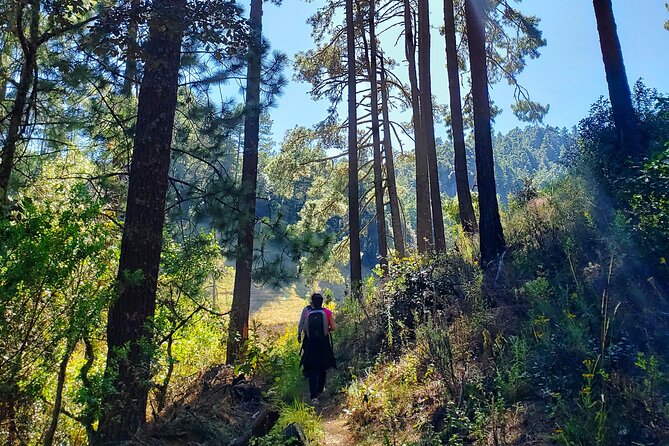
This isn’t the kind of tour where you spend most of the day staring out a bus window. You’re actually walking through the Sierra Norte’s conifer-and-hardwood mix, climbing to higher air where the views get bigger and the vegetation changes. And because the schedule builds in time for food and village life, it feels like a day you’d want to repeat—not just a checklist.
You’ll also get a guided layer that matters. The format includes both a professional bilingual guide and a local community guide, so the day has context beyond scenery. Expect plant talk, bird calls, and explanations about what you’re seeing along the way.
Yes, the hike is moderate, not a casual stroll. The good news is that the day is paced for real hiking time (about 3.5 hours on foot), with stops that keep it from turning into a sprint.
Price and value: why $107.54 can work for your budget
At $107.54 per person, this tour looks like a “pay more, get more” kind of day. The value is in what’s included: private air-conditioned vehicle transport, park entrance fees, breakfast and lunch, drinking water to refill your bottle, hiking poles, and a local community guide.
The extra costs are limited and clear. The only specific add-on mentioned is the suspension bridge access fee (70 pesos). Everything else that would normally cost time and money—guiding, entry fees, meals, and transport—is folded in.
If you’re the type who would otherwise pay separately for a guided hike, driving up to the mountains, and meals at the end, this tends to feel fair. And if you prefer small groups, it helps you avoid the “everyone waits while someone figures out their shoelaces” problem.
The full-day schedule, in plain English
You start early—8:00 am—and you’re done by about 4:30–5:00 pm, with the hike itself taking about 3:30 hours. The whole day is built around a steady rhythm: meet in Oaxaca City, drive up, eat breakfast, hike, cross the bridge option, eat lunch in the village, then return down to town.
You also get multiple planned stops inside Cuajimoloyas. Instead of one long pull with no breaks, the day is broken into segments: views, forest walking, plant spotting, and the suspension bridge experience.
That pacing matters on a mountain hike at altitude. You’ll get air changes, photo breaks, and time to catch your breath without feeling rushed.
Stop 1: Templo de San Matías Jalatlaco meeting point
You meet by the front of the Jalatlaco church, at Miguel Hidalgo 211 in Barrio de Jalatlaco. It’s a practical start: you don’t need complicated navigation or a mystery pickup spot.
This meeting point also helps if you’re using public transportation, since it’s listed as near public transit. If you like to arrive early and get your bearings, you can do that without stress.
From here, the day moves fast into the Sierra Norte driving portion.
The 90-minute drive to Cuajimoloyas: expect mountain air
The drive is about 90 minutes as you head up into the mountains. This is more than travel time—it’s your on-ramp to a different climate. Even when it’s pleasant in Oaxaca City, it can feel sharply colder once you get higher and the sky shifts.
The tour format keeps the drive comfortable with a private, air-conditioned vehicle. You’re not stuck soaking in the sun or fighting traffic stress before the hike even begins.
Once you arrive up in the region of Cuajimoloyas, the next step is breakfast—so you’re not just arriving hungry and cold and then trying to start hiking right away.
Breakfast in the mountains: memelas and coffee
Breakfast is included and served in a local eatery in the mountains for about 45 minutes. The menu highlight given is memelas and coffee, which is exactly the kind of simple meal you want before climbing.
This is also a good time to slow down and let your body catch up. At higher elevation, even small physical effort can feel bigger. Eating first helps you hike with steadier energy rather than forcing it on an empty stomach.
If it’s chilly, don’t underestimate layers. People mention it can get cold up there, and having warm clothing matters more than you’d think.
The hike start: 8 km total, moderate but real
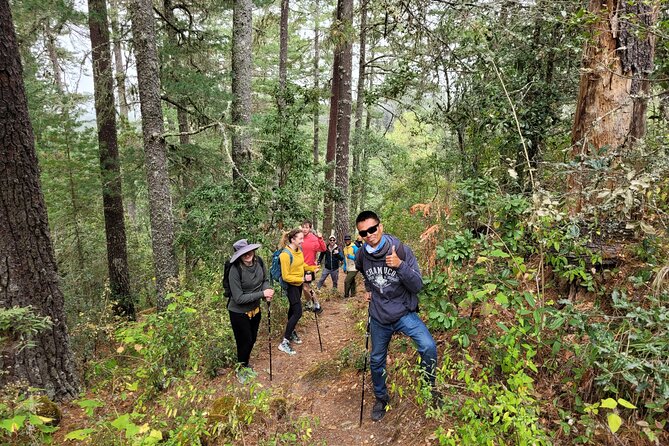
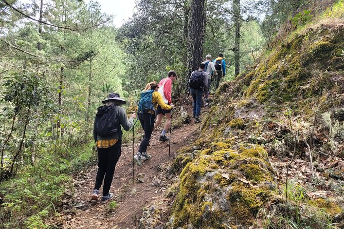
The hike covers roughly 8 km (about 5 miles) total with an estimated hike time around 3.5 hours. Elevation is high, with a minimum around 3,050 m and a maximum around 3,230 m. Elevation gain is listed as 250+ m and also noted as 350+ m in the broader hike details, so treat it like a meaningful climb even if the distance is not enormous.
Difficulty is marked as moderate, with an intermediate skill level. Translation: you can do it if you’re in decent shape and don’t mind getting a bit out of breath. You’ll want to pace yourself, because altitude can do the heavy lifting for you.
The route includes pine forest trails and sections where your hands may help. You’re not doing a technical climb, but it’s not a perfectly flat path either.
What you’ll see while climbing
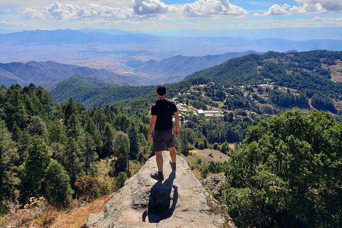
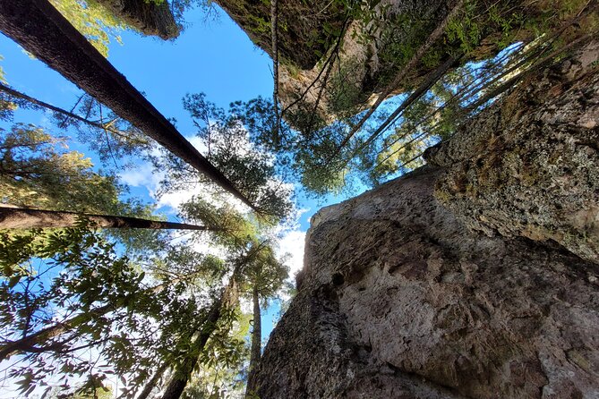
As the hike progresses, you’ll pass through scenery that changes in texture and color: pine forest walking, crevasse areas, and tall rock walls. You’ll also have time to look out over viewpoints that make the climb feel worth it.
A key perk is how the guide points things out. Ivan and the local community guide spend time on native plants and even bird spotting—so you’re not just walking, you’re learning what to notice.
Views, plants, ferns, and giant agaves in the Sierra Norte
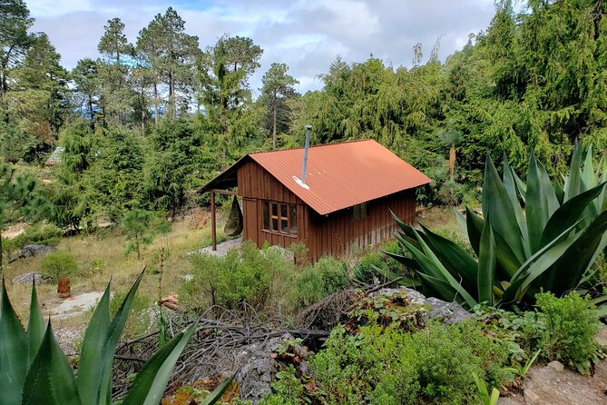
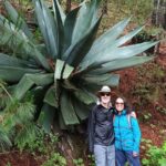
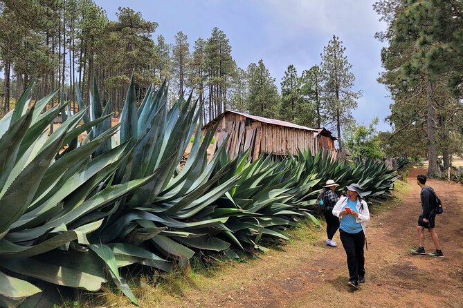
One of the best parts of this day is how much you’re encouraged to pay attention to living things you’d normally walk past. The hike includes time to see native plants, ferns, wildflowers, and striking giant agaves.
You also get explanations that make the plants feel less random. When a guide names what you’re looking at and explains how it matters locally, your eyes stay busy instead of zoning out.
This is also where a local community guide earns their place. The day isn’t only about the hike; it’s about understanding the area as a place people actually live, farm, and navigate season to season.
Crossing the 100+ meter suspension bridge (and the 70-peso fee)
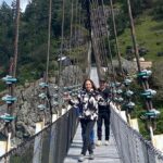
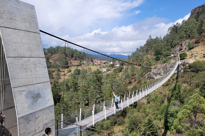
One of the standout moments is the suspension bridge, listed as 100+ meters. It’s reached after you’ve already built up views and time on the trail, so it feels like a reward instead of an early gimmick.
Important practical detail: bridge access costs 70 pesos and is not included. If you want the full experience, budget for it.
If you’re comfortable with heights, this is likely one of your favorite photos of the day. If heights make you nervous, you can still enjoy the views around it and move at a pace that feels safe.
Lunch in the village: homemade mountain food
After the hike segments, you get lunch in the village with authentic, homemade mountain cuisine included for about 45 minutes. The experience is often described as filling and homey—like eating in the way people actually eat where you’re visiting, not like a staged restaurant meal.
The format uses a local comedor, which keeps things simple and local. For many people, this is the moment that turns the day from a hiking outing into a real cultural exchange.
And because you have time to sit, eat, and reset, lunch also helps you recover before the long drive back to Oaxaca City.
Why the two guides make the day feel worth it
This tour isn’t just a person leading a route. It includes a professional bilingual guide plus a local community guide. That pairing changes the kind of answers you get on the trail.
Ivan is the host name many people mention, and what stands out is how organized he is and how much he enjoys sharing Oaxaca—especially the plant life, birds, and culture tied to where you are. Along the path, the guide helps you spot things like medicinal plants and birds.
The local guide adds a calming, grounded presence too, which matters when you’re dealing with elevation and hands-on trail moments. When someone is giving you context at the same time you’re navigating rocky sections, it turns stress into focus.
It’s also a value point. Instead of paying for a guide who only tells you where to step, you’re getting interpretive guidance that makes the walk feel purposeful.
Altitude and conditions: your best move is planning layers
You’re hiking at roughly 3,000+ meters. Even if you’re not currently training for altitude, your body will notice. People describe needing to catch their breath occasionally, which is normal.
Cold is a theme. It can be chilly up high, and you’ll be more comfortable if you wear layers you can manage while hiking and while standing still for views.
If weather turns—rain or overcast is possible—the tour is designed to keep things moving. People mention spare ponchos provided during some conditions, which helps you stay upright and warm enough to enjoy the day.
Practical packing tips based on what’s emphasized:
- Bring layers you can take on/off
- Wear sturdy hiking shoes for mixed terrain
- Bring a water bottle you can refill (water refill is included)
- Know that hiking poles are provided, but you still choose how you want to use them
Who should book this hike (and who should skip it)
This is for you if you want a change of pace from Oaxaca City and you’re excited about a guided day in the mountains. You should feel good about a moderate hike with about 5 miles total walking and real elevation.
It’s also a good fit if you like learning outdoors: plants, birds, and how the local community experiences the land. If you enjoy cultural context alongside hiking, this format is built for that.
This tour is not recommended if you have mobility impairments or respiratory issues, and it’s also not recommended for low fitness levels. The trail includes hands-on moments and elevation that can push your breathing.
If you’re unsure where you fall, be honest about your fitness and altitude comfort. This is one of those tours where trying to muscle through because you paid can spoil the fun for everyone.
Should you book this Oaxaca-to-Cuajimoloyas hike?
If you want an authentic mountain day with village food, guided nature spotting, and a route that feels like an actual hike, I’d book it. The small group size, included meals, and combination of professional guiding plus local community input make it feel like a complete experience rather than a half-day diversion.
Skip it if you hate heights, struggle with altitude, or you know breathing issues could flare up. Also be realistic about the “moderate” label: you’ll be moving steadily for hours, at high elevation, with some terrain that asks a bit more than just walking.
My take: this is a strong value when you want Sierra Norte hiking plus indigenous village life in one day—and you’re willing to dress for cold and take the climb seriously.
FAQ
How long is the hike during the tour?
The hike time is about 3.5 hours (approx.). The total hiking distance is about 8 km (5 miles) total.
What is the meeting point in Oaxaca City?
You meet by the front of the Templo de San Matías Jalatlaco at Miguel Hidalgo 211, Barrio de Jalatlaco, Oaxaca de Juárez.
What time does the adventure start and end?
The tour starts at 8:00 am. It finishes back at the meeting point around 4:30–5 pm.
What’s included in the price?
Included are a professional bilingual guide, fully guided informative tour, private air-conditioned transportation, park entrance fees, breakfast and lunch, drinking water to refill your bottle, hiking poles, and a local community guide.
Is the suspension bridge included?
No. Access to the suspension bridge costs 70 pesos and is not included.
What kind of hike difficulty should I expect?
The hike is described as moderate, with intermediate skill level. It includes elevation gain around 250+ m (and also noted as 350+ m in the hike details) and some hands-on sections.
How cold should I dress for?
The area can be cold up in the mountains, so bring layers. If rain happens, ponchos may be provided.
What language is the tour offered in?
The tour is offered in English.
How big is the group?
The maximum group size is 6 travelers.
Is the tour refundable if plans change?
Yes. You can cancel for free up to 24 hours in advance for a full refund. If you cancel less than 24 hours before the start time, it’s not refunded.