REVIEW · KAMPALA
Rwenzori Mountains Trekking with Margherita Peak Summit
Book on Viator →Operated by Bujuku Eco Tours & Travel Ltd · Bookable on Viator
Uganda’s moon mountains feel otherworldly. This 7-day trek through Rwenzori Mountains National Park turns rainforest and bamboo into mossy bogs and then into glacier country before you aim for Margherita Peak at 5,109m. I love how the park shifts biome by biome, especially the alpine flora that includes giant heathers, lobelias, and groundsel.
I also like the steady, hands-on feel of the trip. You start with a briefing at Nyakalengijja, then move hut to hut—Nyabitaba, John Matte, Bujuku, and Elena—so you spend less time figuring things out and more time hiking. Along the way, you might catch wildlife such as black-and-white colobus monkeys, blue monkeys, and the Rwenzori turaco, with the Mubuku River corridor doing a lot of the work for you.
The big drawback is effort and conditions. The Margherita summit push is rough—three glaciers, slippery rock, ice, and exposed sections—plus the operator notes that climbing gear is not included. If cold, height, and technical terrain make you nervous, this one can feel like a fight.
In This Review
- Key Highlights Worth Booking This For
- Rwenzori Mountains: Rainforest to Glaciers in One Trek
- Getting To Nyakalengijja From Entebbe: Pickup and First Briefing
- Nyabitaba Hut: The Mubuku River Forest and a Big First Climb
- Kurt Shafer Bridge to John Matte Hut: Bamboo, Mossy Slippery Rock, and Views
- Bigo Bog and Bujuku Lake to Bujuku Hut: Tussocks, Cold Ooze, and Acclimatization Time
- Elena Hut and the Margherita Build-Up: Groundsel Gully to 5,109m Ambition
- Margherita Summit Day on Mount Stanley: Three Glaciers and Exposed Sides
- Freshfield Pass to Guy Yeoman Camp: Congo Views and 1906 Expedition Ground
- Kichuchu Cliffs to Mihunga Gate: Completing the Loop Down the Mubuku
- Price and What’s Actually Included at $1,400
- The Support Factor: How Guides Like Joeffery and Johnson Matter
- Gear, Pace, and Weather: How to Make Cold, Bog, and Ice Feel Safer
- Who This Trek Fits Best (and Who Should Rethink It)
- Final Take: Should You Book This Rwenzori Margherita Trek?
- FAQ
- What is the main summit on this trek?
- How long is the trek?
- What kind of pickup is offered?
- Are meals included?
- Is park admission included?
- What is not included in the price?
- Is this tour private?
- What fitness level do I need?
- Is full cancellation available if plans change?
Key Highlights Worth Booking This For
- Margherita Peak (5,109m) summit on Mount Stanley, with a glacier-and-exposed scramble day
- Albertine Rift alpine world: giant heathers, lobelias, groundsel, and rare high-zone vegetation
- Hut-to-hut rhythm (Nyabitaba, John Matte, Bujuku, Elena, Guy Yeoman) that keeps logistics simple
- Bog walking that’s real: Lower Bigo Bog and Bujuku Lake area with tussock hopping and cold ooze risks
- Strong on-the-ground support, with past trekkers crediting guides such as Joeffery and Johnson and quick planning by Geofrey/Geoffrey
Rwenzori Mountains: Rainforest to Glaciers in One Trek
The Rwenzori range is called the Mountains of the Moon for a reason: in equatorial Africa, you get something that feels like alpine Europe—cold air, high ridges, and vegetation that only grows in this kind of elevation. Rwenzori Mountains National Park protects the highest parts of a mountain range roughly 120 km long and 65 km wide, and it’s a wildlife and bird hotspot too, with 70 mammals and 217 bird species listed, including 19 Albertine Rift endemics.
What I like most about this trek is the way it forces you to experience the park as a living system, not just a backdrop. You start in thick forest along river corridors, then move through bamboo and mossy rock, and finally get into true high-alpine terrain where bogs, lakes, and glaciers shape the trail.
If you care about authentic nature time, this is one of those trips where the scenery is not staged. It’s just… there. And it changes fast.
Getting To Nyakalengijja From Entebbe: Pickup and First Briefing
The tour starts at Entebbe Airport, with pickup offered. In practice, that means you’re not left hunting for transport the morning you should be thinking about waterproof layers and a strong breakfast.
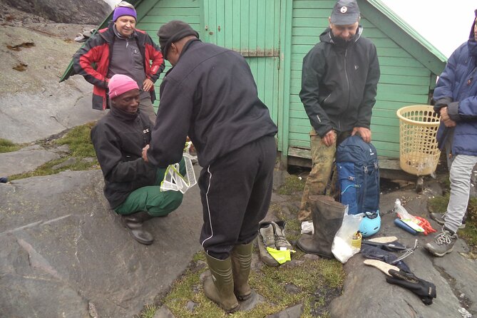
Once you’re in position, you’re driven to Nyakalengijja for a trip briefing and gear organization. That matters more than people think. When you’re about to walk into humid forest, then later into freezing, exposed glacier country, having your equipment sorted early helps you avoid little mistakes that snowball on a long trek.
This is also listed as a private tour/activity, meaning it’s only your group. You’ll keep the day-to-day rhythm without the added friction of constantly adapting to other walkers’ pace.
Nyabitaba Hut: The Mubuku River Forest and a Big First Climb
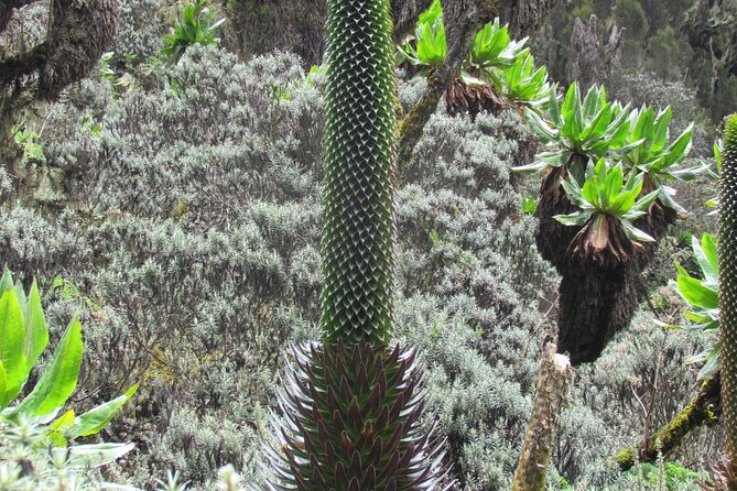
Your first hiking stretch begins with farmland outside the park, then transitions at the boundary into thick forest along the Mubuku River. You cross the Mahoma River tributary, then the trail turns into a long, steep grind up onto a massive ridge toward Nyabitaba hut.
This day is listed as about 6–7 hours, with elevation height provided as 1,036m. Even if that’s not all pure “gain” in the way you’d measure in some trekking plans, you should still treat it as a serious first-day effort. The goal here isn’t speed. It’s getting your legs ready for a week of uneven footing and changing temperatures.
Wildlife is part of the story. Along this forest section, you may hear chimpanzees and spot black-and-white colobus and blue monkeys. The Rwenzori turaco is specifically mentioned too, which is a nice reminder that this trek isn’t only about the summit—it’s also about birds and forest life while you’re earning your altitude.
Kurt Shafer Bridge to John Matte Hut: Bamboo, Mossy Slippery Rock, and Views
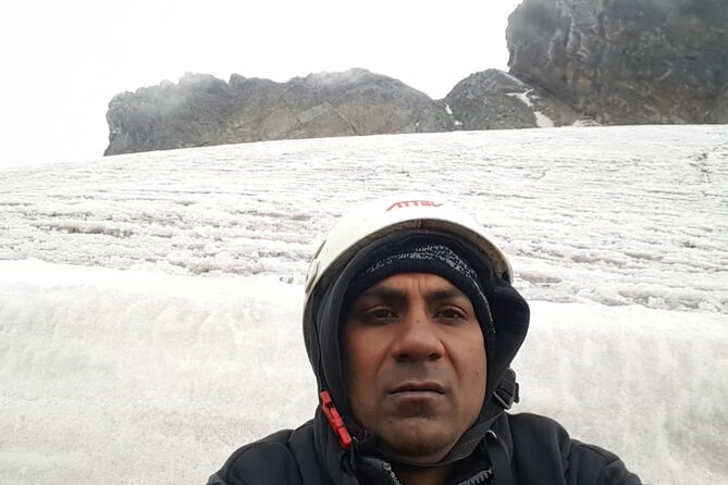
From Nyabitaba, the next day drops through forest down to Kurt Shafer Bridge, just below where the Mubuku and Bujuku rivers meet. You pass through bamboo forest and then hit one exhausting stretch: slippery moss-covered rock.
This is the section where I’d slow my pace on purpose. Moss on rock doesn’t care if you’re “almost there.” Keeping your footing and saving your ankles for later matters more than shaving minutes.
You’ll eventually reach Nyamuleju rock shelter with views out toward Mount Stanley and Mount Speke. Then the trail transitions into the giant heather, lobelia, and groundsel zone—high-altitude plants that make the Rwenzoris feel so different from other African hikes.
You finish at John Matte Hut after a day that includes bog travel. It’s listed as 7–8 hours for this segment. Plan on the last hour feeling longer than the first.
Bigo Bog and Bujuku Lake to Bujuku Hut: Tussocks, Cold Ooze, and Acclimatization Time
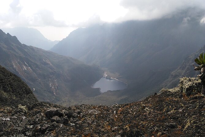
The next move takes you down to cross the Bujuku River and into Lower Bigo Bog. This is classic Rwenzori terrain. You’ll be jumping from tussock to tussock, and the trek description notes that people rarely cross without their feet sampling some freezing ooze.
That line is doing a lot of work. It’s warning you that you can be careful and still get wet. So don’t treat “dry socks” as a promise. Treat it as a best-case scenario.
You cross the bog, then the route gives way to Bujuku Lake. Views are specifically described: Mt Baker to the south and Mt Stanley to the west. That’s a great reminder that even when the walking is difficult, the mountain is rewarding you with big, clear sightlines.
You end at Bujuku Hut in a narrow valley below Stuhlmann Pass. This camp is described as good for acclimatization, especially for clients attempting higher peaks like Mount Stanley and Mount Speke. Translation: you’re not just getting from point A to B. You’re building your body’s tolerance for height and cold before the summit day.
Elena Hut and the Margherita Build-Up: Groundsel Gully to 5,109m Ambition
Leaving Bujuku, you continue through more bog, then climb the steep slopes west of the lake. Groundsel Gully is part of the route and it feels like a turning point from “green and wet” to “cool and sharp.” You turn right up toward Elena Hut and Mount Stanley on a steep trail over large boulders.
Here’s where the plan makes a split in the story. The left trail leads to Scott-Elliot Pass and down toward Kitandara Lakes, and that’s for those not climbing Margherita Peak. If you are climbing Margherita, you continue onward to Elena Hut—described as cool and icy.
This is listed as a 5–6 hour day. Elevation height is given as 579m. I’d treat it as both physical work and mental preparation. You’re going to summit at altitude, in cold, and on terrain that can be exposed.
Even if the weather is kind, your body will still feel the week stacking up. Elena Hut is where you start paying attention to how you breathe, how you drink water, and how quickly your hands get numb.
Margherita Summit Day on Mount Stanley: Three Glaciers and Exposed Sides
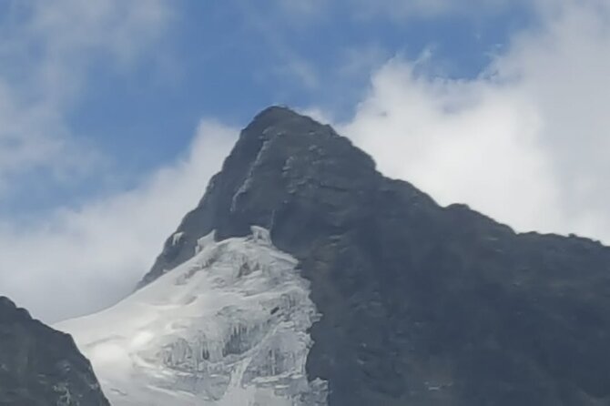
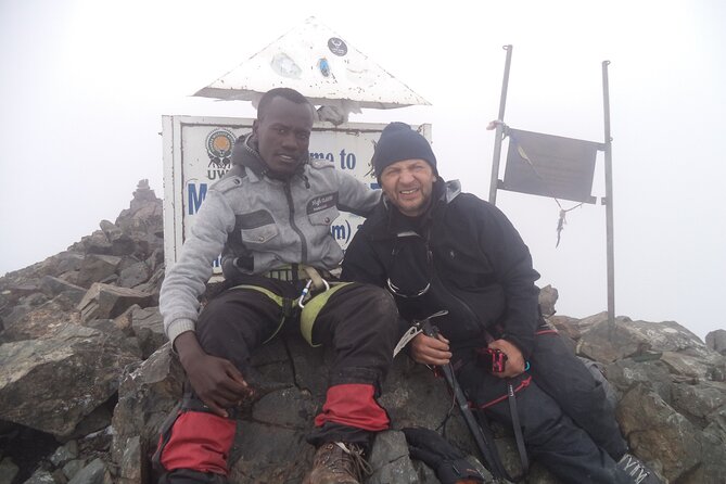
The summit attempt starts early in the morning. To reach Margherita Peak (5,109m asl), the climb is estimated at 4–5 hours depending on weather and pace.
This walk is described as tough for a reason: you go over three glaciers, with slippery rock, ice, and exposed areas open on many sides. That means you’re not just hiking a “high trail.” You’re moving through technical terrain where balance, traction, and careful steps are the difference between smooth progress and stressful scrambling.
The route mentions crossing the Stanley Plateau and ascending after you reach the glaciers. You also climb while adapting to conditions like fog, altitude sickness risk, and cool weather. That’s direct language, and it’s worth respecting. This is not the day to pretend you’re invincible.
When you reach the summit, the trek description frames Margherita as the highest peak of the Rwenzori Mountains. Then you descend back to Elena Hut in about 2–3 hours.
My practical advice: treat the summit as a process, not a single moment. If you focus on steady steps and staying calm in exposed sections, the top feels earned instead of rushed.
Freshfield Pass to Guy Yeoman Camp: Congo Views and 1906 Expedition Ground
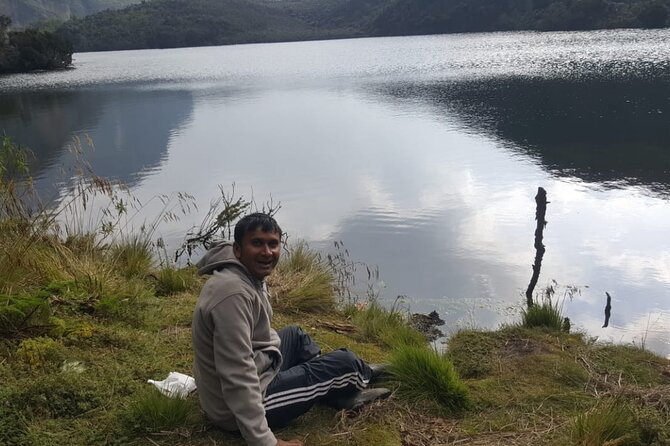
The next day moves toward Freshfield Pass at 4,282m asl. The route is described as ascending steeply up the headwall, continuing along the south side of the mountain and spreading out from the base of Mount Baker.
At the pass, the views are specifically pointed out: you can look into the Congo to the west and see Mount Stanley to the north. This is one of those “even if you’re tired, look around” moments.
After Freshfield Pass, you’re on a long high alpine mossy section, then you start descending through steep rocky trails. You’ll pass a rock shelter at Bujongolo, noted as the base camp for the historic expedition by the Duke of Abruzzi in 1906. That’s a cool connection: people have been chasing these lines for more than a century, and the route still holds that sense of adventure and seriousness.
You finish the day with an overnight at Guy Yeoman camp. This is listed as a 6–7 hour day. You’re tired, but you’re still moving through terrain that demands care with footing.
Kichuchu Cliffs to Mihunga Gate: Completing the Loop Down the Mubuku
On the final trekking day, the route descends the cliffs of Kichuchu below Guy Yeoman. After that, you get a messy, muddy path that crosses the Mubuku River twice through bamboo forest.
Then you climb downward to Nyabitaba to complete the circuit. The trek finishes by evening at Mihunga gate.
This is listed as 7–8 hours for the descent. It’s usually the most exhausting kind of day: you’re not climbing to a goal anymore, but your body is still catching up to the cold, the wet, and the hours you’ve already logged.
The payoff is psychological. Finishing this loop feels like closing a chapter. You start in low, forest air, and you end back at the boundary with that very distinct sense that you traveled through altitude as a real place—not an abstract number.
Price and What’s Actually Included at $1,400
The price is $1,400.00 per person for a trek of about 7 days. For a mountaineering-focused itinerary in a high-altitude national park, the value usually comes from three things: guided logistics, set lodging at mountain huts/camps, and meals.
Here, meals are clearly included: breakfast (7), lunch (7), and dinner (7). Park admission is also listed as free in the trek outline, so you’re not facing extra park-fee surprises during the hike.
Pickup is offered, which saves you from arranging separate transport on arrival and departure. And because it’s a private tour/activity, you avoid the “share everything” crowd dynamic.
The one major line item not included is climbing gear. That’s a big deal on Margherita summit day, where the route mentions glaciers, ice, and exposed terrain. If you show up without the right kit, you’ll either pay to rent last-minute gear locally (if available) or end up with a trip that feels more risky than it needs to.
The Support Factor: How Guides Like Joeffery and Johnson Matter
This trek runs on more than legs. It runs on guidance—route finding in wet terrain, pace control during acclimatization, and sensible decisions when weather changes.
In prior experiences shared with the same operator, guides named Joeffery and Johnson are mentioned as part of what made trips feel well managed and supportive. Geofrey/Geoffrey is also referenced in the context of communication and planning responsiveness. That combination matters: good field leadership plus clear, fast planning before you even arrive.
The practical takeaway for you: ask questions early and get your gear sorted before you land. The better you arrive prepared, the more your guides can focus on safe walking and good timing.
Gear, Pace, and Weather: How to Make Cold, Bog, and Ice Feel Safer
You can’t control fog. You can’t control rain. You can’t control how quickly your feet cool in a bog.
But you can control how you show up and how you move.
The trek description already tells you the reality: mossy slippery rock, bogs with freezing ooze, and a summit day over three glaciers with ice and exposed areas. So plan for cold and plan for wet. The route is also described with cool and icy conditions at Elena Hut and the potential for altitude sickness.
My advice is simple:
- Build in buffer time and don’t rush the early days.
- Expect wet feet at least once—Lower Bigo Bog is the obvious culprit.
- Treat the summit day as weather-dependent. The trek says weather affects the time to summit, so you should expect some flexibility.
If you’ve never walked on glaciated or icy terrain, consider training before you go. At minimum, make sure you understand what you’re agreeing to when you commit to a 5,109m summit attempt.
Who This Trek Fits Best (and Who Should Rethink It)
The trek is listed for travelers with a moderate physical fitness level, but don’t mistake “moderate” for “easy.” You’re walking 6–8 hour days, dealing with boggy sections, and then targeting a high-altitude peak that involves glacier travel.
This route makes sense if you:
- want a serious high-altitude hiking/mountaineering experience
- like wildlife and forest time as much as summit time
- are comfortable with cold, uneven ground, and technical footing
It’s a tougher fit if you:
- hate exposed terrain or feel panicky on ice
- don’t have the climbing gear needed for glacier travel
- are expecting a purely scenic walk with minimal challenge
If you want the summit experience, understand the mountain sets the rules.
Final Take: Should You Book This Rwenzori Margherita Trek?
Book it if Margherita Peak is your goal and you can show up prepared for cold, wet, and technical conditions. The trek’s value is strong because meals are included for the whole week, park admission is listed as free, and you’re supported by a private guiding setup that focuses on safe movement between huts and camps.
Pass or rethink if you’re not ready for glacier-and-exposure realities or you’d struggle without climbing gear. This is one of those hikes where preparation turns fear into focus.
If you’re ready to work for it, you’ll remember the mix of river forest, mossy bogs, giant heather zones, and then that summit day on Mount Stanley like a real achievement—one step at a time.
FAQ
What is the main summit on this trek?
The trek aims to summit Margherita Peak on Mount Stanley, at 5,109m asl.
How long is the trek?
The trek is listed as 7 days (approx.).
What kind of pickup is offered?
Pickup is offered, and the meeting point is Entebbe Airport in Entebbe, Uganda.
Are meals included?
Yes. Breakfast, lunch, and dinner are included for 7 days.
Is park admission included?
Park admission is listed as free in the trek details.
What is not included in the price?
Climbing gear is not included.
Is this tour private?
Yes. It is listed as a private tour/activity, with only your group participating.
What fitness level do I need?
The trek is described as suitable for travelers with moderate physical fitness.
Is full cancellation available if plans change?
Free cancellation is available up to 24 hours in advance for a full refund. Cancellation less than 24 hours before the start time is not refundable.